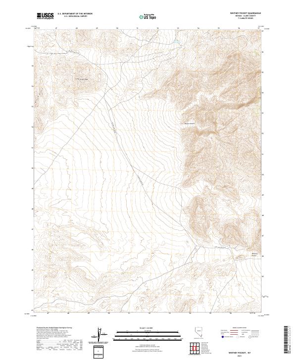
2021 Map of Whitney Pocket
USGS Topo · Published 2021About this map
Little Virgin Peak and the high ridges of Black Ridge define this high-altitude landscape within the Mojave Desert. This 2021 survey by the U.S. Geological Survey details the remote intersection of topography and minimal human infrastructure in Clark County. The primary corridor through the area is New Gold Butte Rd, which winds through the basin toward the namesake Whitney Pocket in the southeast. Water is scarce in this arid environment, making the location of South Key West Spring in the northern portion of the quadrangle a critical historical landmark for those navigating this portion of the Virgin Mountains foothills. The map provides a precise view of the complex land management boundaries including township and range lines across t15s r69e and t16s r70e.
Find a feature on this map
10 named features on this map. Tap any name to fly to it.
Don’t see what you’re looking for? This feature index may not catch every label — zoom into the map to look around manually.
Map Details
Editions of this 2021 Whitney Pocket Map
This is the sole edition of this map. No revisions or reprints were ever made.
Other maps of this area

1886 · Saint Thomas
USGS Topo · 1:250,000

1893 · Saint Thomas
USGS Topo · 1:250,000

1926 · Bonelli
USGS Topo · 1:96,000

1953 · Overton Beach
USGS Topo · 1:62,500

1953 · Gold Butte
USGS Topo · 1:62,500

1954 · Las Vegas
USGS Topo · 1:250,000

1957 · Las Vegas
USGS Topo · 1:250,000

1958 · Virgin Peak
USGS Topo · 1:62,500

1958 · Overton
USGS Topo · 1:62,500

1959 · Las Vegas
USGS Topo · 1:250,000