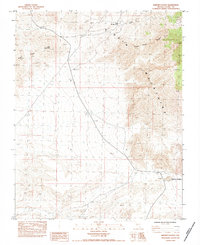
1983 Map of Whitney Pocket
USGS Topo · Published 1984About this map
The Virgin Mountains dominate this high-desert landscape in Clark County, showing a remote stretch of Nevada's topography during the early 1980s. The terrain is defined by prominent peaks and ridges, including Virgin Peak, Little Virgin Peak, and the long spine of Black Ridge. These geographic landmarks provided essential navigation points for travelers and miners in this arid environment.
Find a feature on this map
8 named features on this map. Tap any name to fly to it.
Don’t see what you’re looking for? This feature index may not catch every label — zoom into the map to look around manually.
Map Details
Editions of this 1983 Whitney Pocket Map
This is the sole edition of this map. No revisions or reprints were ever made.
Other maps of this area

1886 · Saint Thomas
USGS Topo · 1:250,000

1893 · Saint Thomas
USGS Topo · 1:250,000

1926 · Bonelli
USGS Topo · 1:96,000

1953 · Overton Beach
USGS Topo · 1:62,500

1953 · Gold Butte
USGS Topo · 1:62,500

1954 · Las Vegas
USGS Topo · 1:250,000

1957 · Las Vegas
USGS Topo · 1:250,000

1958 · Virgin Peak
USGS Topo · 1:62,500

1958 · Overton
USGS Topo · 1:62,500

1959 · Las Vegas
USGS Topo · 1:250,000