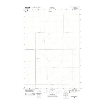
2011 Map of Whitstran NE
USGS Topo · Published 2011About this map
Chandler Butte dominates the northern landscape of this Benton County region, overlooking a geometric grid of rural roads and the drainage of the East Branch Glade Creek. The area is characterized by large-scale agricultural parcels and a network of named thoroughfares including Hayden Rd, SW Hamilton Rd, and Mc Bee Rd. This 2011 survey reflects the intersection of traditional land use and modern infrastructure, shown through the varied terrain of the butte and the steady course of the creek as it flows south toward W Sellars Rd. The presence of Cemetery Rd suggests a established community history, while routes like N Mcbee Grade NW indicate the significant elevation changes found in the northern reaches of the quadrangle.
Find a feature on this map
15 named features on this map. Tap any name to fly to it.
Don’t see what you’re looking for? This feature index may not catch every label — zoom into the map to look around manually.
Map Details
Editions of this 2011 Whitstran NE Map
This is the sole edition of this map. No revisions or reprints were ever made.
Other maps of this area

1915 · Prosser
USGS Topo · 1:125,000

1917 · Pasco
USGS Topo · 1:125,000

1917 · Prosser
USGS Topo · 1:125,000

1951 · Richland
USGS Topo · 1:62,500

1951 · Corral Canyon
USGS Topo · 1:62,500

1953 · Walla Walla
USGS Topo · 1:250,000

1958 · Walla Walla
USGS Topo · 1:250,000

1965 · Whitstran
USGS Topo · 1:62,500
1965 · Prior Ranch
USGS Topo · 1:24,000
1965 · Whitstran SE
USGS Topo · 1:24,000