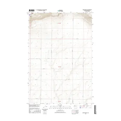
2017 Map of Whitstran NE
USGS Topo · Published 2017About this map
Horse Heaven Hills rise across the northern section of this Benton County landscape, peaking at Chandler Butte in the northernmost reaches. The terrain is defined by a series of south-trending ridges and draws, with the E Br Glade Cr cutting through the central portion of the quadrangle. The map captures a grid of rural roads and land boundaries, including several that appear tied to local family or historical identifiers, such as N Mcbee Rd and Tyacke Rd. The southern half of the area is crisscrossed by thoroughfares like Stephen Rd and Cemetery Rd, suggesting established access to the high plateau country. This 2017 survey reflects the enduring character of the high Washington desert, where the township and range lines of t8n r26e and t9n r26e organize a landscape primarily shaped by elevation and drainage.
Find a feature on this map
17 named features on this map. Tap any name to fly to it.
Don’t see what you’re looking for? This feature index may not catch every label — zoom into the map to look around manually.
Map Details
Editions of this 2017 Whitstran NE Map
This is the sole edition of this map. No revisions or reprints were ever made.
Other maps of this area

1915 · Prosser
USGS Topo · 1:125,000

1917 · Pasco
USGS Topo · 1:125,000

1917 · Prosser
USGS Topo · 1:125,000

1951 · Richland
USGS Topo · 1:62,500

1951 · Corral Canyon
USGS Topo · 1:62,500

1953 · Walla Walla
USGS Topo · 1:250,000

1958 · Walla Walla
USGS Topo · 1:250,000

1965 · Whitstran
USGS Topo · 1:62,500
1965 · Prior Ranch
USGS Topo · 1:24,000
1965 · Whitstran SE
USGS Topo · 1:24,000