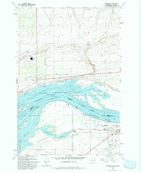
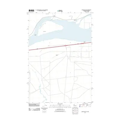
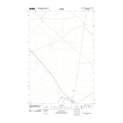
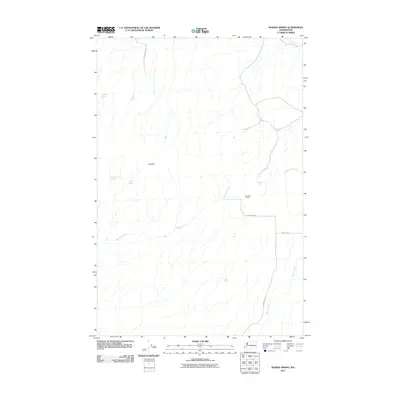
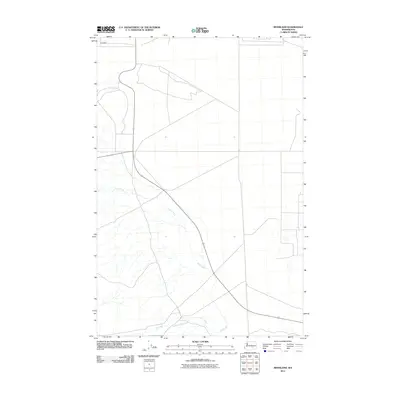
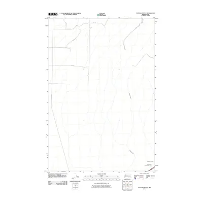
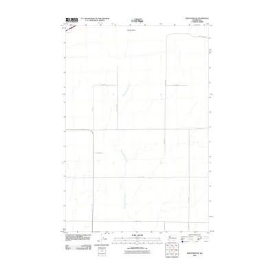
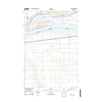
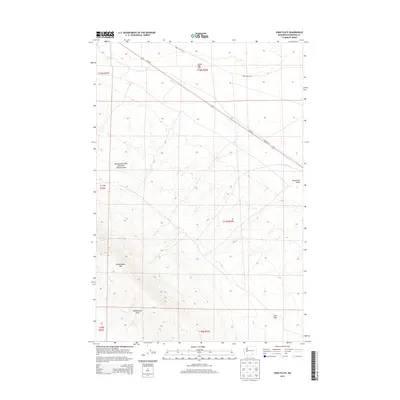
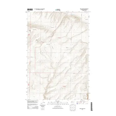
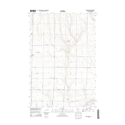
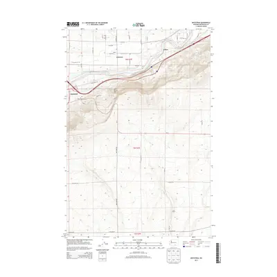
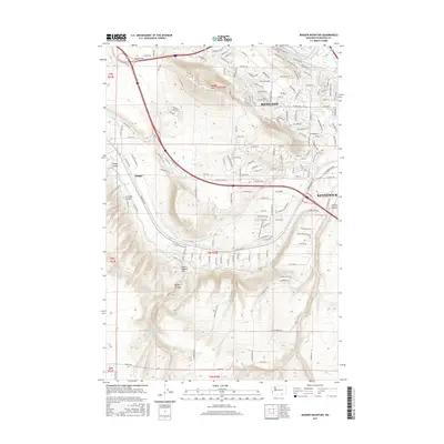
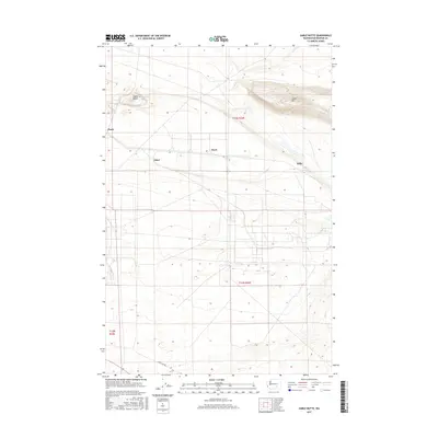
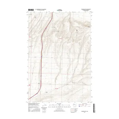
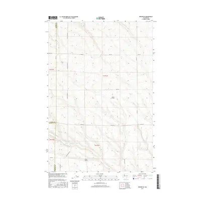
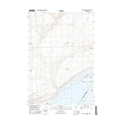
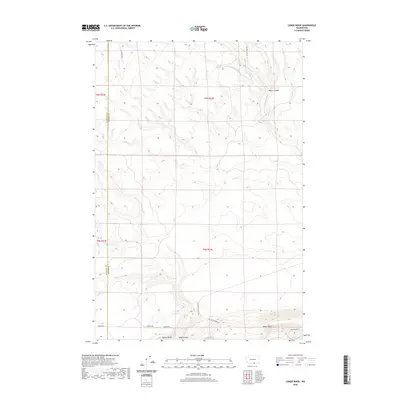
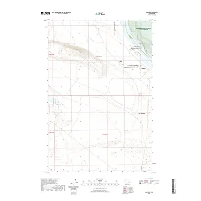
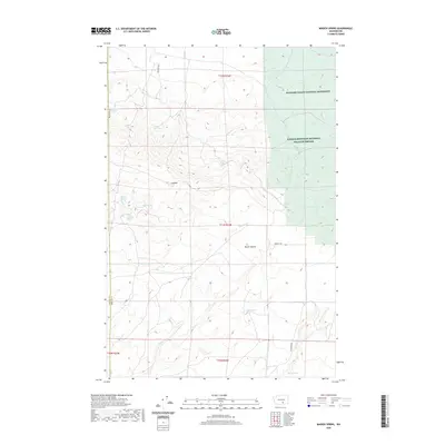
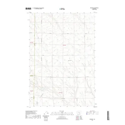
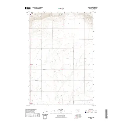
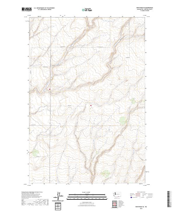
1965 Map of Whitstran NE
USGS Topo · Published 1967About this map
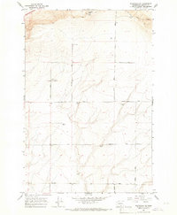
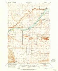
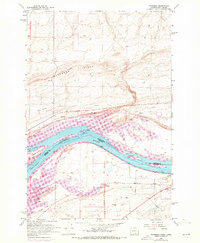
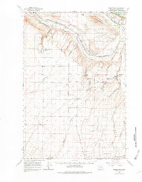
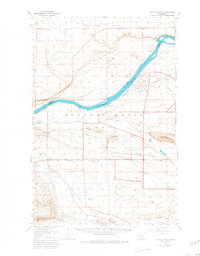
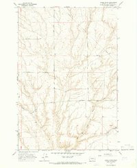
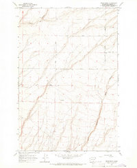
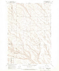
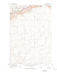
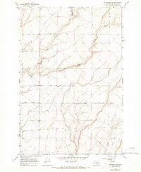
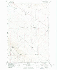
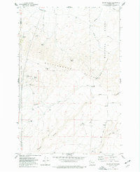
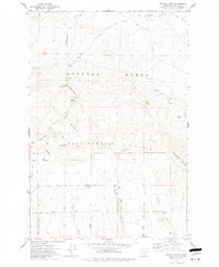
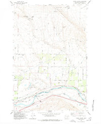
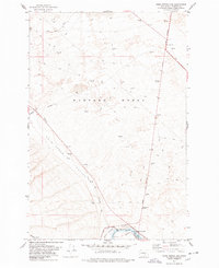
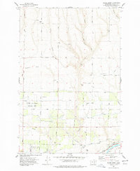
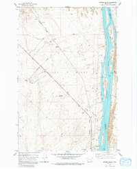
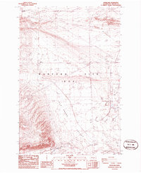
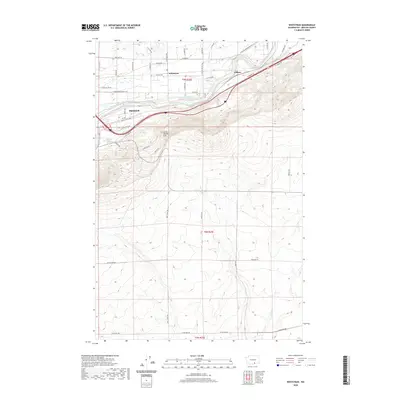
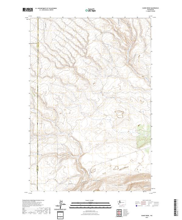
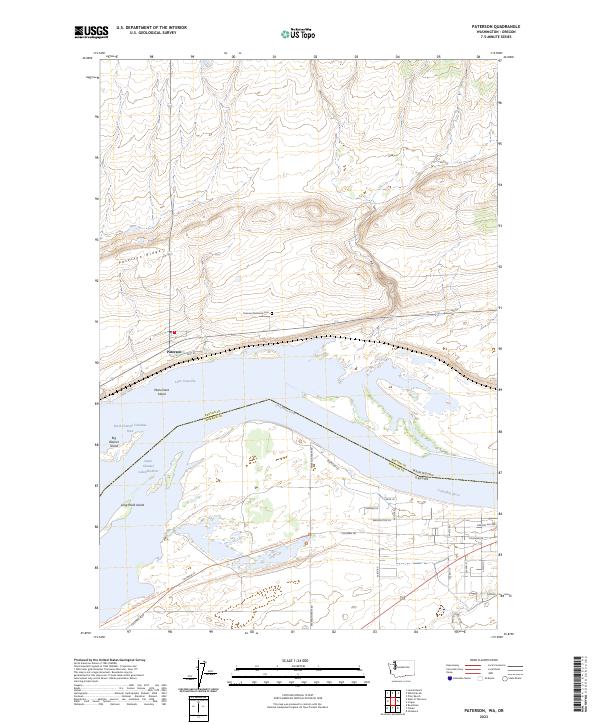
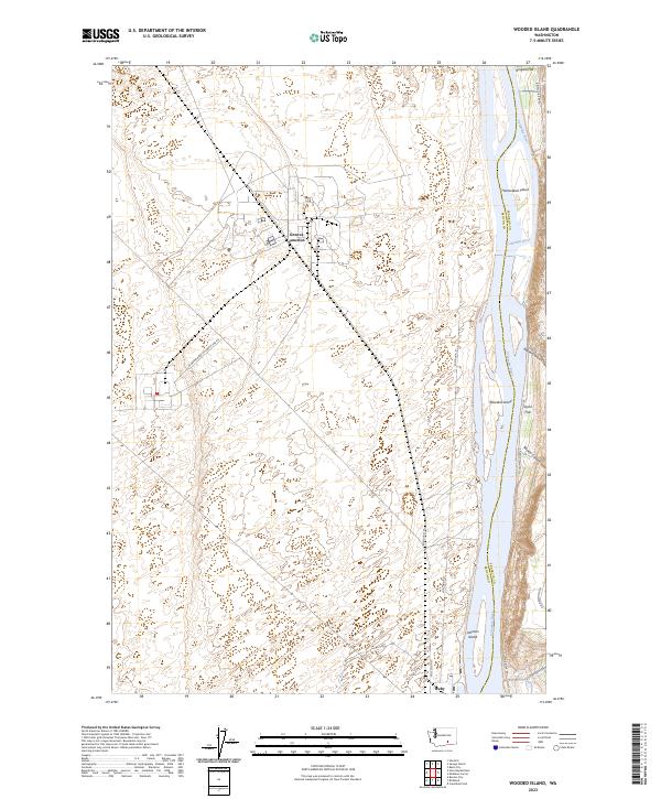
Chandler Butte dominates the northern horizon of this agricultural region in Benton County, where the high desert terrain transitions into a organized grid of dryland farming and infrastructure. During the mid-1960s, the area relied heavily on a network of named thoroughfares like Hamilton Road, Gould Road, and Mc Bee Road to connect scattered operations. The landscape is defined by its industrial agriculture, evidenced by multiple Grain Elevator locations and several Storage Bins situated along these rural routes. A modest Landing Strip and Radio Facilities near the butte suggest a reliance on aerial and telecommunication support for the vast acreage. Local history is etched into the names of the roads, such as Sellards Road and Tyacke Road, which likely reflect the early families who settled and worked this portion of the Washington interior, while Cemetery Road marks a quiet corner of community life.
Find a feature on this map
22 named features on this map. Tap any name to fly to it.
Don’t see what you’re looking for? This feature index may not catch every label — zoom into the map to look around manually.
Map Details
Editions of this 1965 Whitstran NE Map
This is the sole edition of this map. No revisions or reprints were ever made.
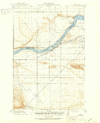
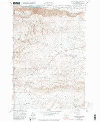
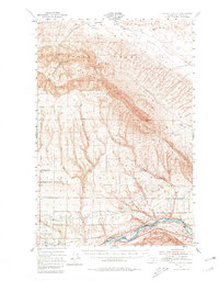
Historical Maps of Benton County Through Time
173 maps found
1916 Coyote Rapids
Benton County, WA
1948 Emerson Nipple
Benton County, WA
1951 Corral Canyon
Benton County, WA
1951 Coyote Rapids
Benton County, WA
1962 Blalock Island
Benton County, WA
1962 Canoe Ridge
Benton County, WA
1962 Crow Butte
Benton County, WA
1962 Paterson
Benton County, WA
1964 Johnson Butte
Benton County, WA
1964 Nine Canyon
Benton County, WA
1965 Badger Mtn
Benton County, WA
1965 Badger Mtn
Benton County, WA
1965 Coyote Rapids
Benton County, WA
1965 Lenzie Ranch
Benton County, WA
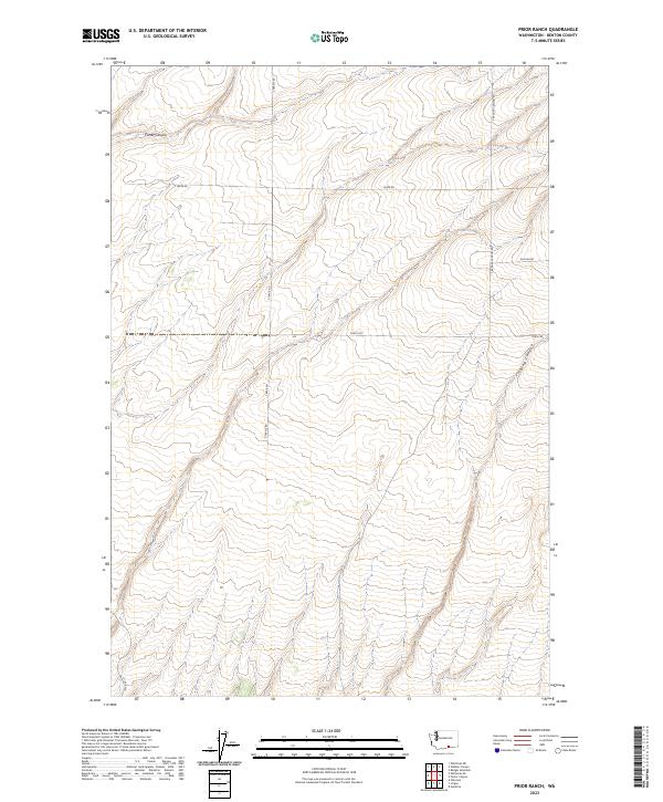
1965 Prior Ranch
Benton County, WA
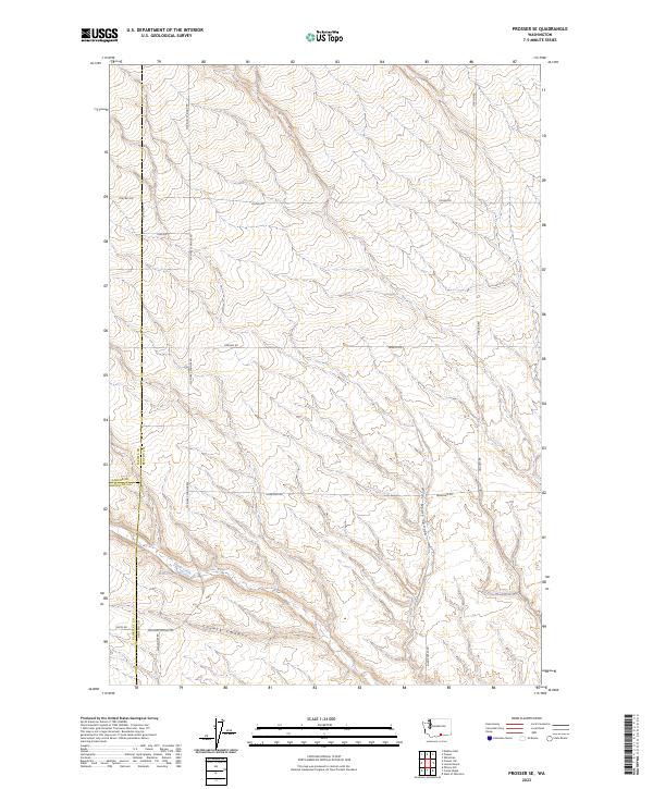
1965 Prosser SE
Benton County, WA
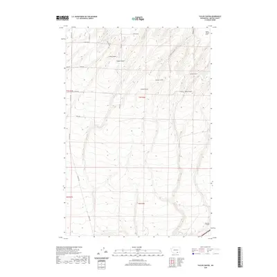
1965 Taylor Canyon
Benton County, WA
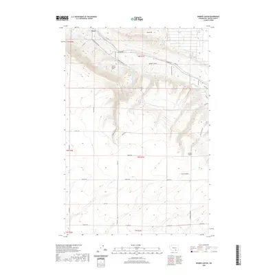
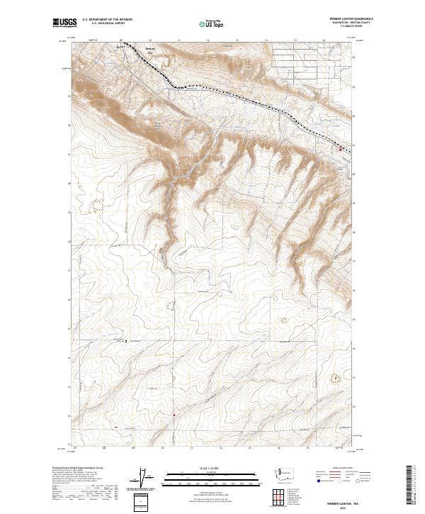
1965 Weber Canyon
Benton County, WA
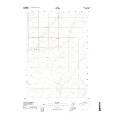
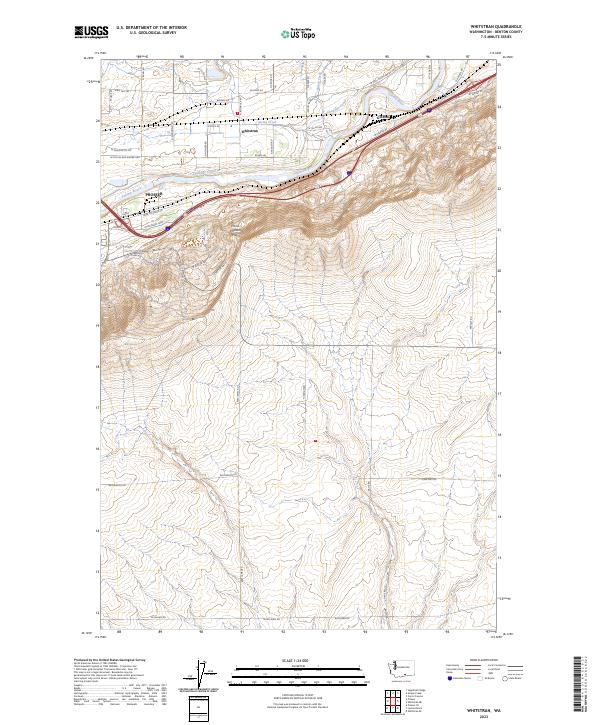
1965 Whitstran
Benton County, WA
1965 Whitstran
Benton County, WA
1965 Whitstran NE
Benton County, WA
1965 Whitstran SE
Benton County, WA
1974 Iowa Flats
Benton County, WA
1974 Maiden Spring
Benton County, WA
1974 Snively Basin
Benton County, WA
1977 Corral Canyon
Benton County, WA
1977 Horn Rapids Dam
Benton County, WA
1977 Snipes Creek
Benton County, WA
1978 Wooden Island
Benton County, WA
1979 Sagebrush Ridge
Benton County, WA
1986 Gable Butte
Benton County, WA
1986 Hanford
Benton County, WA
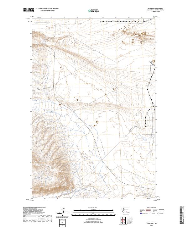
1986 Riverland
Benton County, WA
1992 Wooden Island
Benton County, WA
1993 Canoe Ridge
Benton County, WA
1993 Crow Butte
Benton County, WA
1993 Paterson
Benton County, WA
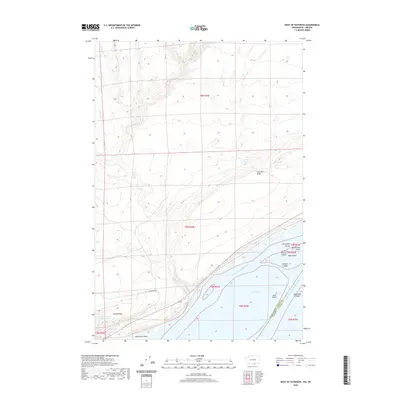
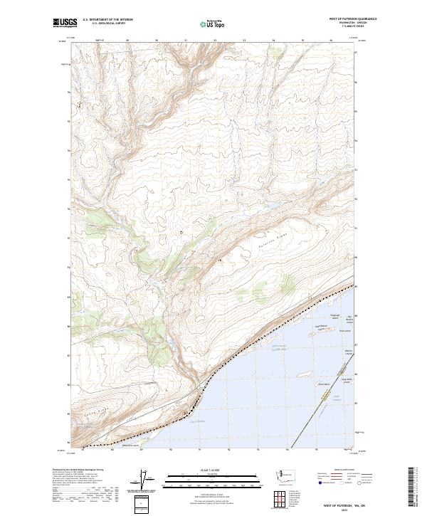
1993 West of Paterson
Benton County, WA
2011 Badger Mountain
Benton County, WA

2011 Canoe Ridge
Benton County, WA
2011 Corral Canyon
Benton County, WA
2011 Crow Butte
Benton County, WA
2011 Emerson Nipple
Benton County, WA
2011 Gable Butte
Benton County, WA
2011 Hanford
Benton County, WA
2011 Horn Rapids Dam
Benton County, WA
2011 Iowa Flats
Benton County, WA
2011 Johnson Butte
Benton County, WA
2011 Lenzie Ranch
Benton County, WA
2011 Maiden Spring
Benton County, WA

2011 Nine Canyon
Benton County, WA
2011 Paterson
Benton County, WA
2011 Prior Ranch
Benton County, WA
2011 Prosser SE
Benton County, WA
2011 Riverland
Benton County, WA
2011 Sagebrush Ridge
Benton County, WA
2011 Snipes Creek
Benton County, WA
2011 Snively Basin
Benton County, WA
2011 Taylor Canyon
Benton County, WA
2011 Webber Canyon
Benton County, WA
2011 West of Paterson
Benton County, WA
2011 Whitstran
Benton County, WA
2011 Whitstran NE
Benton County, WA

2011 Whitstran SE
Benton County, WA
2011 Wooded Island
Benton County, WA

2013 Badger Mountain
Benton County, WA
2013 Canoe Ridge
Benton County, WA
2013 Corral Canyon
Benton County, WA
2013 Crow Butte
Benton County, WA
2013 Emerson Nipple
Benton County, WA
2013 Gable Butte
Benton County, WA

2013 Hanford
Benton County, WA
2013 Horn Rapids Dam
Benton County, WA
2013 Iowa Flats
Benton County, WA
2013 Johnson Butte
Benton County, WA
2013 Lenzie Ranch
Benton County, WA
2013 Maiden Spring
Benton County, WA
2013 Nine Canyon
Benton County, WA

2013 Paterson
Benton County, WA
2013 Prior Ranch
Benton County, WA
2013 Prosser SE
Benton County, WA

2013 Riverland
Benton County, WA
2013 Sagebrush Ridge
Benton County, WA
2013 Snipes Creek
Benton County, WA
2013 Snively Basin
Benton County, WA
2013 Webber Canyon
Benton County, WA
2013 West of Paterson
Benton County, WA
2013 Whitstran
Benton County, WA
2013 Whitstran NE
Benton County, WA

2013 Whitstran SE
Benton County, WA
2014 Taylor Canyon
Benton County, WA
2014 Wooded Island
Benton County, WA
2017 Badger Mountain
Benton County, WA
2017 Canoe Ridge
Benton County, WA
2017 Corral Canyon
Benton County, WA
2017 Crow Butte
Benton County, WA

2017 Emerson Nipple
Benton County, WA
2017 Gable Butte
Benton County, WA
2017 Hanford
Benton County, WA
2017 Horn Rapids Dam
Benton County, WA
2017 Iowa Flats
Benton County, WA
2017 Johnson Butte
Benton County, WA

2017 Lenzie Ranch
Benton County, WA
2017 Maiden Spring
Benton County, WA

2017 Nine Canyon
Benton County, WA
2017 Paterson
Benton County, WA
2017 Prior Ranch
Benton County, WA
2017 Prosser SE
Benton County, WA
2017 Riverland
Benton County, WA
2017 Sagebrush Ridge
Benton County, WA

2017 Snipes Creek
Benton County, WA
2017 Snively Basin
Benton County, WA

2017 Taylor Canyon
Benton County, WA

2017 Webber Canyon
Benton County, WA
2017 West of Paterson
Benton County, WA

2017 Whitstran
Benton County, WA

2017 Whitstran NE
Benton County, WA
2017 Whitstran SE
Benton County, WA
2017 Wooded Island
Benton County, WA
2020 Badger Mountain
Benton County, WA
2020 Canoe Ridge
Benton County, WA
2020 Corral Canyon
Benton County, WA

2020 Crow Butte
Benton County, WA
2020 Emerson Nipple
Benton County, WA
2020 Gable Butte
Benton County, WA
2020 Hanford
Benton County, WA
2020 Horn Rapids Dam
Benton County, WA
2020 Iowa Flats
Benton County, WA
2020 Johnson Butte
Benton County, WA

2020 Lenzie Ranch
Benton County, WA
2020 Maiden Spring
Benton County, WA
2020 Nine Canyon
Benton County, WA
2020 Paterson
Benton County, WA
2020 Prior Ranch
Benton County, WA
2020 Prosser SE
Benton County, WA
2020 Riverland
Benton County, WA
2020 Sagebrush Ridge
Benton County, WA
2020 Snipes Creek
Benton County, WA

2020 Snively Basin
Benton County, WA
2020 Taylor Canyon
Benton County, WA
2020 Webber Canyon
Benton County, WA
2020 West of Paterson
Benton County, WA
2020 Whitstran
Benton County, WA
2020 Whitstran NE
Benton County, WA
2020 Whitstran SE
Benton County, WA
2020 Wooded Island
Benton County, WA
2023 Badger Mountain
Benton County, WA
2023 Canoe Ridge
Benton County, WA
2023 Corral Canyon
Benton County, WA
2023 Crow Butte
Benton County, WA
2023 Emerson Nipple
Benton County, WA
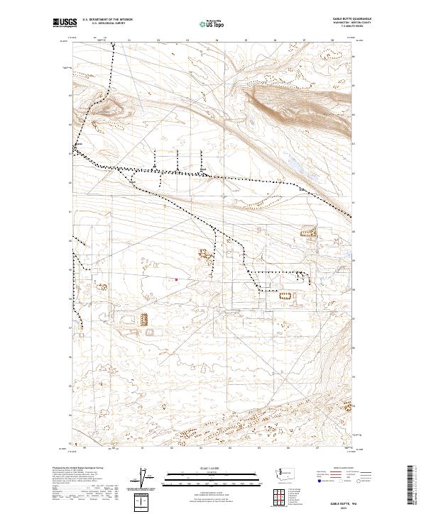
2023 Gable Butte
Benton County, WA
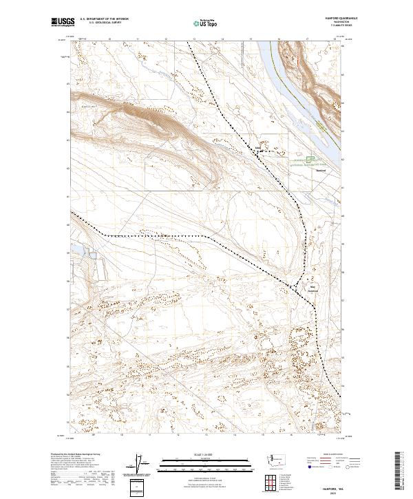
2023 Hanford
Benton County, WA
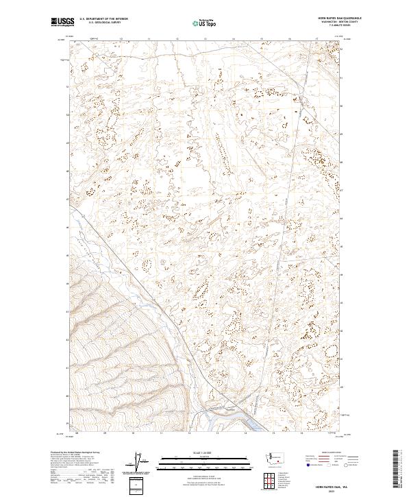
2023 Horn Rapids Dam
Benton County, WA
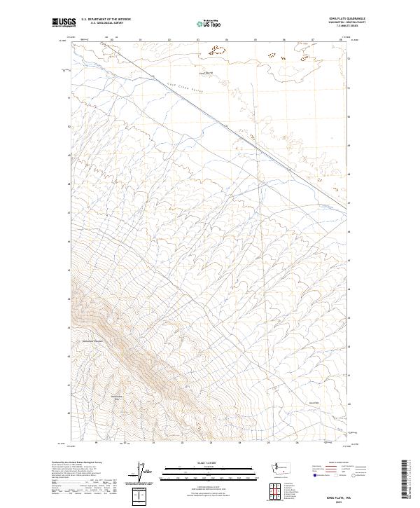
2023 Iowa Flats
Benton County, WA
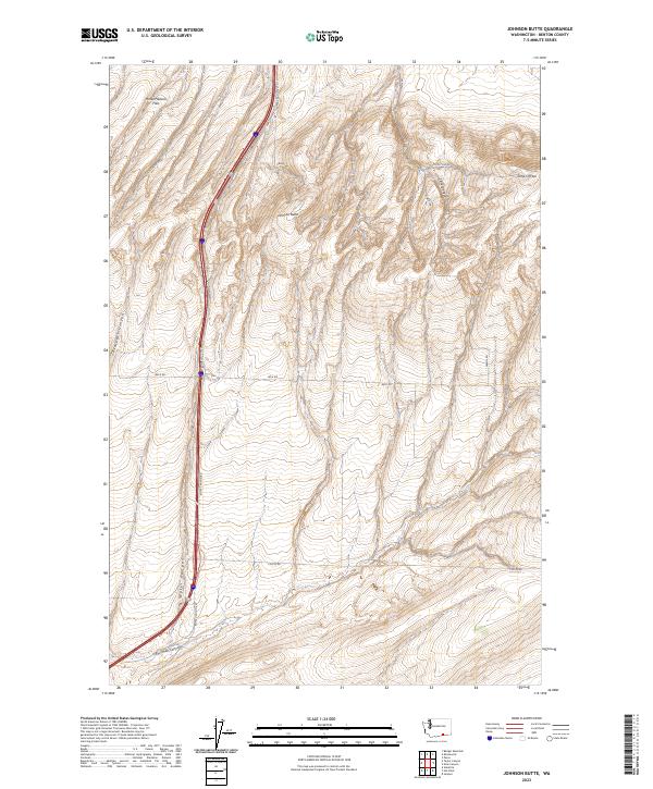
2023 Johnson Butte
Benton County, WA
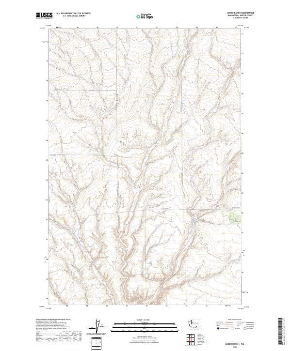
2023 Lenzie Ranch
Benton County, WA
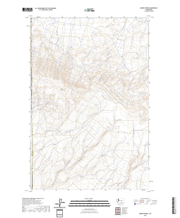
2023 Maiden Spring
Benton County, WA
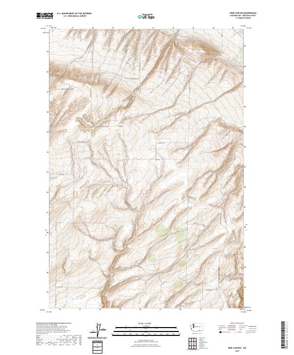
2023 Nine Canyon
Benton County, WA
2023 Paterson
Benton County, WA
2023 Prior Ranch
Benton County, WA
2023 Prosser SE
Benton County, WA
2023 Riverland
Benton County, WA
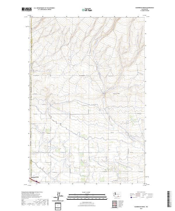
2023 Sagebrush Ridge
Benton County, WA
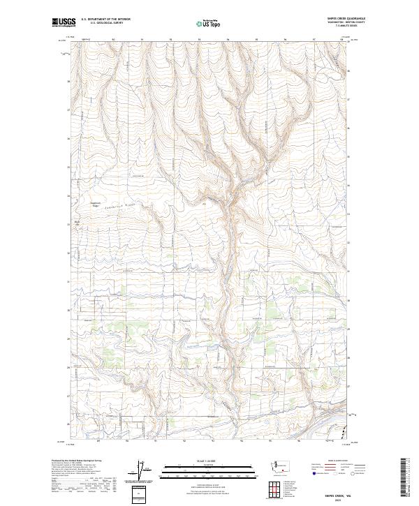
2023 Snipes Creek
Benton County, WA
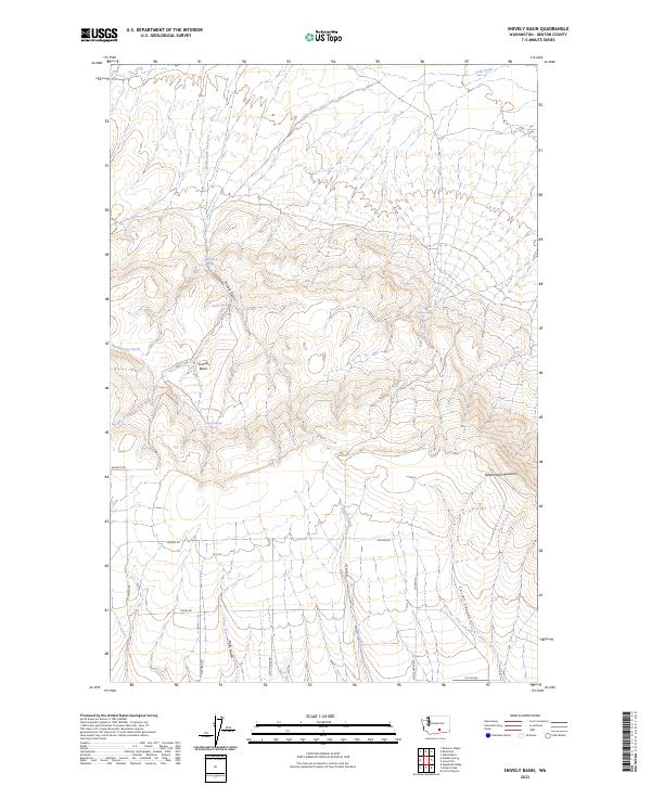
2023 Snively Basin
Benton County, WA
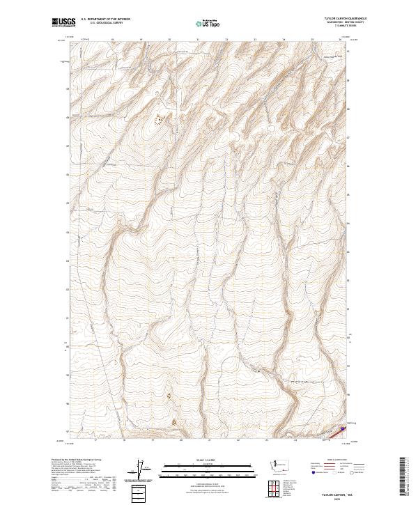
2023 Taylor Canyon
Benton County, WA
2023 Webber Canyon
Benton County, WA
2023 West of Paterson
Benton County, WA
2023 Whitstran
Benton County, WA

2023 Whitstran NE
Benton County, WA
2023 Whitstran SE
Benton County, WA
2023 Wooded Island
Benton County, WA