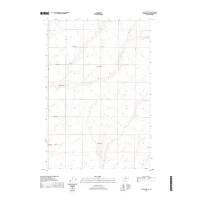
2020 Map of Whitstran SE
USGS Topo · Published 2020About this map
Carter Canyon and the surrounding plateau of Benton County define this portion of the Horse Heaven region. The landscape is characterized by its organized agricultural grid and deep drainage features, notably E Br Glade Cr which cuts through the central terrain. While much of the area is dominated by large-scale farming, the network of rural roads reveals the names of early land-holding families. Local researchers will find many legacy thoroughfares such as Rydeholm Rd, Anderson Rd, and Tyacke Rd that cross the townships. The topographical data provides a modern look at the land's contours and drainage patterns, illustrating how the natural geography of the canyons interacts with the straight-line development of eastern Washington's high country.
Find a feature on this map
15 named features on this map. Tap any name to fly to it.
Don’t see what you’re looking for? This feature index may not catch every label — zoom into the map to look around manually.
Map Details
Editions of this 2020 Whitstran SE Map
This is the sole edition of this map. No revisions or reprints were ever made.
Other maps of this area

1906 · Blalock Island
USGS Topo · 1:125,000

1908 · Blalock Island
USGS Topo · 1:125,000

1908 · Umatilla
USGS Topo · 1:125,000

1915 · Prosser
USGS Topo · 1:125,000

1917 · Pasco
USGS Topo · 1:125,000

1917 · Prosser
USGS Topo · 1:125,000

1953 · Pendleton
USGS Topo · 1:250,000

1953 · Walla Walla
USGS Topo · 1:250,000

1956 · Pendleton
USGS Topo · 1:250,000

1958 · Walla Walla
USGS Topo · 1:250,000