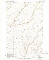
1965 Map of Whitstran SE
USGS Topo · Published 1966About this map
Glade Creek and its tributary, the East Branch, carve a distinct drainage system through the arid heights of Benton County. This mid-1960s survey captures a landscape defined by industrial and agricultural infrastructure, where a network of family-named roads like Horrigan Road and Lenzie Road provides access to remote wells and local industrial sites such as a Gravel Pit. The presence of a Gaging Station along the creek indicates the importance of water management in this high-desert environment. Topographic variations are most pronounced along the deep incisions of Carter Canyon and Tyacke Canyon to the northeast, while a prominent Pipeline cuts across the southern sections, marking the intersection of natural terrain and regional utility development during this era of post-war growth in the Pacific Northwest.
Find a feature on this map
17 named features on this map. Tap any name to fly to it.
Don’t see what you’re looking for? This feature index may not catch every label — zoom into the map to look around manually.
Map Details
Editions of this 1965 Whitstran SE Map
This is the sole edition of this map. No revisions or reprints were ever made.
Other maps of this area

1906 · Blalock Island
USGS Topo · 1:125,000

1908 · Blalock Island
USGS Topo · 1:125,000

1908 · Umatilla
USGS Topo · 1:125,000

1915 · Prosser
USGS Topo · 1:125,000

1917 · Pasco
USGS Topo · 1:125,000

1917 · Prosser
USGS Topo · 1:125,000

1953 · Pendleton
USGS Topo · 1:250,000

1953 · Walla Walla
USGS Topo · 1:250,000

1956 · Pendleton
USGS Topo · 1:250,000

1958 · Walla Walla
USGS Topo · 1:250,000