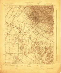
1923 Map of Whittier
USGS Topo · Published 1923About this map
Whittier and its surrounding ranchos appear here as an intensive grid of orchards, oil fields, and burgeoning suburban tracts in the early 1920s. The landscape is structured by the historic boundaries of Paso De Bartolo, Santa Gertrudes, and Los Coyotes, reflecting the area's transition from vast land grants to subdivided agricultural and industrial hubs. Infrastructure like the Pacific Electric railway and the Atchison Topeka and Santa Fe (San Diego Branch) connects settlements such as Norwalk and Rivera to the regional economy. Notably, the map captures the institutional footprint of the era, including the expansive Norwalk State Hospital and the State Reform School. The dense network of named lanes, such as Anaheim Telegraph Road and Workman Mill Road, reveals the detailed transit patterns established before the mid-century highway boom.
Find a feature on this map
51 named features on this map. Tap any name to fly to it.
Don’t see what you’re looking for? This feature index may not catch every label — zoom into the map to look around manually.
Map Details
Editions of this 1923 Whittier Map
This is the sole edition of this map. No revisions or reprints were ever made.
Other maps of this area

1894 · Los Angeles
USGS Topo · 1:62,500

1894 · Pomona
USGS Topo · 1:62,500

1896 · Pasadena
USGS Topo · 1:62,500

1896 · Anaheim
USGS Topo · 1:62,500

1896 · Downey
USGS Topo · 1:62,500

1897 · Pomona
USGS Topo · 1:62,500

1898 · Pomona
USGS Topo · 1:62,500

1898 · Anaheim
USGS Topo · 1:62,500

1899 · Downey
USGS Topo · 1:62,500

1900 · Pasadena
USGS Topo · 1:62,500