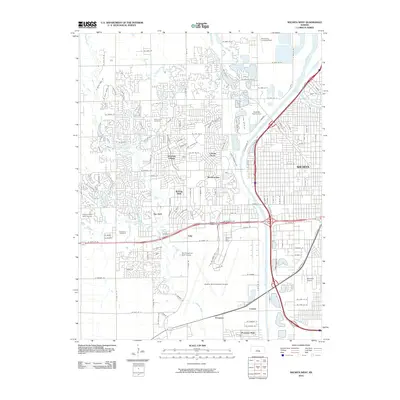
2010 Map of Wichita West
USGS Topo · Published 2010About this map
The Arkansas River and the massive Wichita Valley Center Floodway define the eastern drainage of this suburban landscape, which by 2010 had developed into a complex network of residential subdivisions and critical infrastructure. Centered on the western reaches of Wichita, the map details a transition from dense neighborhoods like Westlink Village and Meadowview to the sprawling grounds of the Wichita Mid-Continent Airport. This era shows a high concentration of recreational and community spaces, including the Sedgwick County Zoo near Horseshoe Lake, and significant memorial sites such as Resthaven Cemetery and Resurrection Cemetery. Water features like Big Slough, Couskin Creek, and Cadillac Lake are woven throughout the residential developments, illustrating the area's integrated approach to flood management and land use during this period of expansion.
Find a feature on this map
142 named features on this map. Tap any name to fly to it.
Don’t see what you’re looking for? This feature index may not catch every label — zoom into the map to look around manually.
Map Details
Editions of this 2010 Wichita West Map
This is the sole edition of this map. No revisions or reprints were ever made.
Other maps of this area

1889 · Cheney
USGS Topo · 1:125,000

1889 · Wichita
USGS Topo · 1:125,000

1891 · Cheney
USGS Topo · 1:125,000

1894 · Wichita
USGS Topo · 1:125,000

1901 · Cheney
USGS Topo · 1:125,000

1941 · Maize
USGS Topo · 1:31,680

1941 · Valley Center
USGS Topo · 1:31,680

1942 · Valley Center
USGS Topo · 1:31,680

1942 · Maize
USGS Topo · 1:31,680

1943 · Wichita West
USGS Topo · 1:31,680