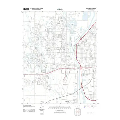
2012 Map of Wichita West
USGS Topo · Published 2012About this map
Wichita Mid-Continent Airport dominates the central-southern portion of this landscape, marking a massive aviation footprint in the western reaches of the city. To the north, the Sedwick County Zoo and surrounding residential areas like Westlink Village and Rolling Hills show the suburban character of the late twentieth and early twenty-first centuries. The drainage of Cowskin Cr and the Big Slough define the natural waterways, while the engineered Wichita-Valley Center Floodway and Arkansas River channel water through the eastern edge of the quadrangle. Local history is etched into the landscape via the Resurrection Cem, Jamesburg Cem, and the Rest haven Cem, providing valuable points of reference for genealogists. Educational and commercial hubs are also visible, including Newman Univ and the Ashley Park Towne Centre.
Find a feature on this map
62 named features on this map. Tap any name to fly to it.
Don’t see what you’re looking for? This feature index may not catch every label — zoom into the map to look around manually.
Map Details
Editions of this 2012 Wichita West Map
This is the sole edition of this map. No revisions or reprints were ever made.
Other maps of this area

1889 · Cheney
USGS Topo · 1:125,000

1889 · Wichita
USGS Topo · 1:125,000

1891 · Cheney
USGS Topo · 1:125,000

1894 · Wichita
USGS Topo · 1:125,000

1901 · Cheney
USGS Topo · 1:125,000

1941 · Maize
USGS Topo · 1:31,680

1941 · Valley Center
USGS Topo · 1:31,680

1942 · Valley Center
USGS Topo · 1:31,680

1942 · Maize
USGS Topo · 1:31,680

1943 · Wichita West
USGS Topo · 1:31,680