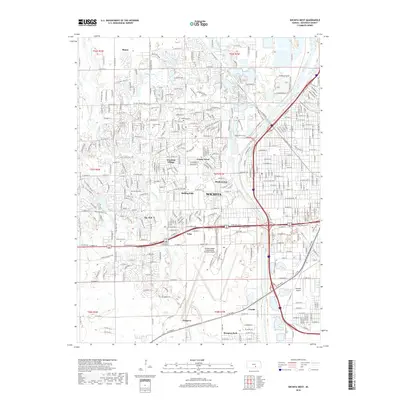
2018 Map of Wichita West
USGS Topo · Published 2018About this map
Wichita's western suburban expansion is captured in high detail, showing the intricate street grids and neighborhood divisions that define the area's modern footprint. The landscape is anchored by the massive Wichita Dwight D Eisenhower National Airport and the smaller Westport Airport, reflecting the region's deep ties to aviation. Residential developments like Westlink Village, Meadowview, and Rolling Hills are interspersed with significant recreational and memorial sites, including Sedgwick Co Park, Resurrection Cem, and Resthaven Cem.
Find a feature on this map
50 named features on this map. Tap any name to fly to it.
Don’t see what you’re looking for? This feature index may not catch every label — zoom into the map to look around manually.
Map Details
Editions of this 2018 Wichita West Map
This is the sole edition of this map. No revisions or reprints were ever made.
Other maps of this area

1889 · Cheney
USGS Topo · 1:125,000

1889 · Wichita
USGS Topo · 1:125,000

1891 · Cheney
USGS Topo · 1:125,000

1894 · Wichita
USGS Topo · 1:125,000

1901 · Cheney
USGS Topo · 1:125,000

1941 · Maize
USGS Topo · 1:31,680

1941 · Valley Center
USGS Topo · 1:31,680

1942 · Valley Center
USGS Topo · 1:31,680

1942 · Maize
USGS Topo · 1:31,680

1943 · Wichita West
USGS Topo · 1:31,680