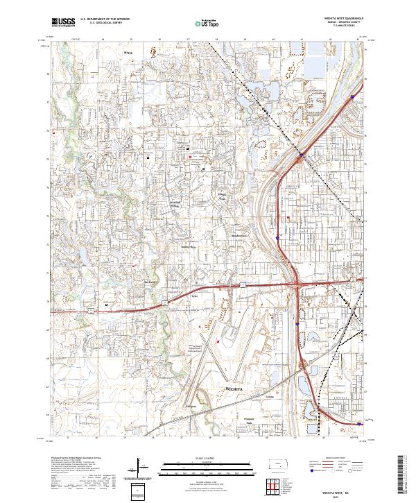
2023 Map of Wichita West
USGS Topo · Published 2023About this map
Wichita’s western suburban expansion is meticulously documented in this 2023 edition, showing the complex interplay between aviation infrastructure and residential development. The vast footprint of the Wichita Dwight D Eisenhower National Airport dominates the southern half of the map, flanked by settlements like Tyler and Prospect. To the north, the landscape transitions into a dense network of neighborhoods including Westlink Village, County Acres, and Meadowview. Local history and genealogy are anchored by several established burial grounds, most notably Resthaven Cem, Resurrection Cem, and Jamesburg Park Cem. The eastern edge is defined by the course of the Arkansas River and the Big Slough, while Newman University serves as a prominent institutional landmark near the heart of the city’s western reaches.
Find a feature on this map
41 named features on this map. Tap any name to fly to it.
Don’t see what you’re looking for? This feature index may not catch every label — zoom into the map to look around manually.
Map Details
Editions of this 2023 Wichita West Map
This is the sole edition of this map. No revisions or reprints were ever made.
Other maps of this area

1889 · Cheney
USGS Topo · 1:125,000

1889 · Wichita
USGS Topo · 1:125,000

1891 · Cheney
USGS Topo · 1:125,000

1894 · Wichita
USGS Topo · 1:125,000

1901 · Cheney
USGS Topo · 1:125,000

1941 · Maize
USGS Topo · 1:31,680

1941 · Valley Center
USGS Topo · 1:31,680

1942 · Valley Center
USGS Topo · 1:31,680

1942 · Maize
USGS Topo · 1:31,680

1943 · Wichita West
USGS Topo · 1:31,680