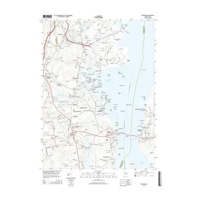
2015 Map of Wickford
USGS Topo · Published 2015About this map
Wickford and its surrounding coastal villages are depicted here during a period of modern development that remains deeply anchored by its colonial-era footprint. The landscape is defined by the complex shoreline of the West Passage, where numerous points and coves like Fishing Cove and Duck Cove meet the Atlantic Ocean. The settlement pattern reflects the area's maritime and industrial roots, with legacy villages such as Davisville, Hamilton, and Lafayette clustered around vital water sources like the Annaquatucket River and Sandhill Brook.
Find a feature on this map
224 named features on this map. Tap any name to fly to it.
Don’t see what you’re looking for? This feature index may not catch every label — zoom into the map to look around manually.
Map Details
Editions of this 2015 Wickford Map
This is the sole edition of this map. No revisions or reprints were ever made.
Other maps of this area

1889 · Charlestown
USGS Topo · 1:62,500

1889 · Newport
USGS Topo · 1:62,500

1890 · Narragansett Bay
USGS Topo · 1:62,500

1890 · Kent
USGS Topo · 1:62,500

1892 · Narragansett Bay
USGS Topo · 1:62,500

1894 · Kent
USGS Topo · 1:62,500

1894 · Newport
USGS Topo · 1:62,500

1904 · Newport
USGS Topo · 1:62,500

1919 · Charlestown
USGS Topo · 1:62,500

1919 · Narragansett Bay
USGS Topo · 1:62,500