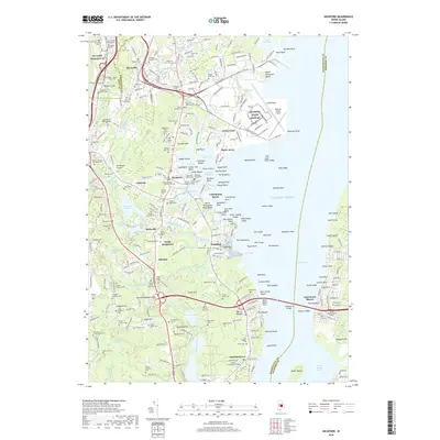
2018 Map of Wickford
USGS Topo · Published 2018About this map
Wickford Harbor and the dense network of coastal inlets define the eastern edge of this landscape, where the historic maritime character of Wickford meets the industrial and military footprint of Quonset State Airport. The map reveals a high density of colonial and family burial grounds, such as the Saint Paul - Eliphalet Updike Cem - Young Plot and the Old Baptist Meetinghouse Yard, providing a remarkable record of early settlement patterns and genealogy. Inland, the terrain is shaped by the Annaquatucket River and numerous mill-related water bodies like Rodman Mill Pond, reflecting the region's industrial heritage. Transportation corridors like the Amtrak rail line and Tower Hill Rd connect established villages like Lafayette and Belleville with the surrounding coastal topography of Spink Neck and Saunderstown.
Find a feature on this map
182 named features on this map. Tap any name to fly to it.
Don’t see what you’re looking for? This feature index may not catch every label — zoom into the map to look around manually.
Map Details
Editions of this 2018 Wickford Map
This is the sole edition of this map. No revisions or reprints were ever made.
Other maps of this area

1889 · Charlestown
USGS Topo · 1:62,500

1889 · Newport
USGS Topo · 1:62,500

1890 · Narragansett Bay
USGS Topo · 1:62,500

1890 · Kent
USGS Topo · 1:62,500

1892 · Narragansett Bay
USGS Topo · 1:62,500

1894 · Kent
USGS Topo · 1:62,500

1894 · Newport
USGS Topo · 1:62,500

1904 · Newport
USGS Topo · 1:62,500

1919 · Charlestown
USGS Topo · 1:62,500

1919 · Narragansett Bay
USGS Topo · 1:62,500