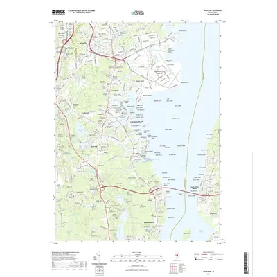
2021 Map of Wickford
USGS Topo · Published 2021About this map
Wickford Harbor and its complex network of coves and inlets define this coastal landscape on the West Passage of Narragansett Bay. This modern record reveals an area where 18th-century maritime history meets 20th-century aviation infrastructure at Quonset State Airport. The inland terrain is notably dense with family burial grounds, such as the Jeffrey Davis Lot and Pardon Tillinghast Lot Cem, offering a deep genealogical layer for the settlements of Davisville and Lafayette.
Find a feature on this map
331 named features on this map. Tap any name to fly to it.
Don’t see what you’re looking for? This feature index may not catch every label — zoom into the map to look around manually.
Map Details
Editions of this 2021 Wickford Map
This is the sole edition of this map. No revisions or reprints were ever made.
Other maps of this area

1889 · Charlestown
USGS Topo · 1:62,500

1889 · Newport
USGS Topo · 1:62,500

1890 · Narragansett Bay
USGS Topo · 1:62,500

1890 · Kent
USGS Topo · 1:62,500

1892 · Narragansett Bay
USGS Topo · 1:62,500

1894 · Kent
USGS Topo · 1:62,500

1894 · Newport
USGS Topo · 1:62,500

1904 · Newport
USGS Topo · 1:62,500

1919 · Charlestown
USGS Topo · 1:62,500

1919 · Narragansett Bay
USGS Topo · 1:62,500