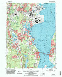
1995 Map of Wickford
USGS Topo · Published 1999About this map
The coastal village of Wickford and its surrounding harbor define this detailed topographical study of the North Kingstown shoreline. During the mid-1990s, the landscape reflects a complex mix of historic maritime settlement and large-scale federal activity, most notably at the US Naval Reservation and its construction battalion center. The map reveals the intricate water network of the Annaquatucket River and Mill Creek as they empty into Wickford Harbor, protected by the Wickford Lighthouse.
Find a feature on this map
108 named features on this map. Tap any name to fly to it.
Don’t see what you’re looking for? This feature index may not catch every label — zoom into the map to look around manually.
Map Details
Editions of this 1995 Wickford Map
This is the sole edition of this map. No revisions or reprints were ever made.
Other maps of this area

1889 · Charlestown
USGS Topo · 1:62,500

1889 · Newport
USGS Topo · 1:62,500

1890 · Narragansett Bay
USGS Topo · 1:62,500

1890 · Kent
USGS Topo · 1:62,500

1892 · Narragansett Bay
USGS Topo · 1:62,500

1894 · Kent
USGS Topo · 1:62,500

1894 · Newport
USGS Topo · 1:62,500

1904 · Newport
USGS Topo · 1:62,500

1919 · Charlestown
USGS Topo · 1:62,500

1919 · Narragansett Bay
USGS Topo · 1:62,500