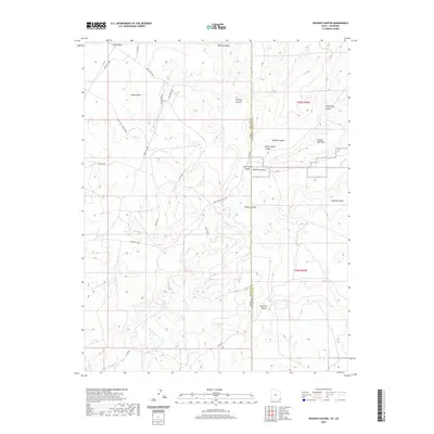
2020 Map of Wickiup Canyon
USGS Topo · Published 2020About this map
Cajon Mesa dominates the high desert landscape of the Four Corners region, where the state line divides San Juan County, Utah, from Montezuma County, Colorado. This modern topographic study reveals a deeply incised drainage network defined by the winding course of McElmo Cr and its numerous tributary canyons. The map illustrates a sparse but critical infrastructure of modern and historical routes, including Ismay Trading Post Rd and several Bureau of Indian Affairs roads such as Indian Rte 5068. Distinctive landforms like Cannon Ball Mesa and Mail Trail Mesa rise above the canyon floor, providing a detailed record of the local geomorphology. The presence of Hovenweep Canyon and Little Ruin Canyon highlights an area with a deep cultural legacy, though the map focuses on current physical features and jurisdictional boundaries across the high plateau.
Find a feature on this map
28 named features on this map. Tap any name to fly to it.
Don’t see what you’re looking for? This feature index may not catch every label — zoom into the map to look around manually.
Map Details
Editions of this 2020 Wickiup Canyon Map
This is the sole edition of this map. No revisions or reprints were ever made.
Other maps of this area

1886 · Abajo
USGS Topo · 1:250,000

1892 · Abajo
USGS Topo · 1:250,000

1893 · Abajo
USGS Topo · 1:250,000

1956 · Cortez
USGS Topo · 1:250,000

1957 · Moqui NW
USGS Topo · 1:24,000

1957 · Aneth 1 NE
USGS Topo · 1:24,000

1957 · Aneth 1 NW
USGS Topo · 1:24,000

1957 · Moqui SW
USGS Topo · 1:24,000

1958 · Sentinel Peak NW
USGS Topo · 1:24,000

1958 · Cortez
USGS Topo · 1:250,000