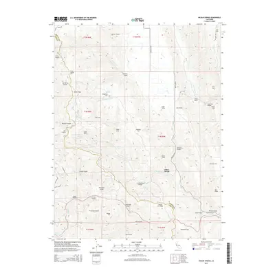
2015 Map of Wilbur Springs
USGS Topo · Published 2015About this map
Wilbur Springs sits at the heart of this landscape where the Colusa and Lake County boundary threads through the northern Coast Ranges. The area is defined by a dense network of water features and thermal indicators, including Sulphur Creek, East Fork Sulphur Creek, and numerous named springs such as Deadshot, Cherry, and Grizzly Spring. This drainage pattern, carved into high points like Cold Spring Mountain and Coyote Peak, highlights a terrain historically utilized for its mineral waters and grazing potential.
Find a feature on this map
98 named features on this map. Tap any name to fly to it.
Don’t see what you’re looking for? This feature index may not catch every label — zoom into the map to look around manually.
Map Details
Editions of this 2015 Wilbur Springs Map
This is the sole edition of this map. No revisions or reprints were ever made.
Other maps of this area

1905 · Fairview
USGS Topo · 1:24,000

1920 · Venado
USGS Topo · 1:62,500

1924 · Bartlett Springs
USGS Topo · 1:62,500

1942 · Bartlett Springs
USGS Topo · 1:62,500

1943 · Morgan Valley
USGS Topo · 1:62,500

1944 · Bartlett Springs
USGS Topo · 1:62,500

1944 · Wilbur Springs
USGS Topo · 1:62,500

1944 · Morgan Valley
USGS Topo · 1:62,500

1945 · Lower Lake
USGS Topo · 1:62,500

1947 · Santa Rosa
USGS Topo · 1:250,000