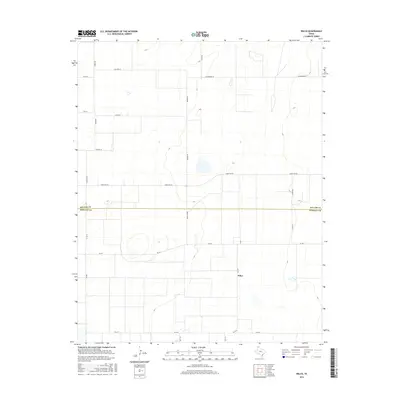
2016 Map of Wilco
USGS Topo · Published 2016About this map
The border between Dallam Co and Hartley Co bisects this High Plains landscape, where the settlement of Wilco sits along the southern corridor of FM 2577. This 2016 survey illustrates the geometric precision of the Texas Panhandle's ranching and agricultural grid, defined by a network of long-established secondary roads like Ranch Rd 297 and FM 281. The naming conventions of the local thoroughfares, such as Summerour Ln, Wynn Ln, Frische Ln, and Haaland Ln, reflect the deep-rooted family lineage of the region's landholders. The topography is characterized by subtle elevation changes and depressions, common in this arid environment, while the proximity to Moore Rd and Field Ln highlights the logistical connectivity essential for the area's sprawling cattle and grain operations.
Find a feature on this map
23 named features on this map. Tap any name to fly to it.
Don’t see what you’re looking for? This feature index may not catch every label — zoom into the map to look around manually.
Map Details
Editions of this 2016 Wilco Map
This is the sole edition of this map. No revisions or reprints were ever made.
Other maps of this area

1954 · Tucumcari
USGS Topo · 1:250,000

1954 · Dalhart
USGS Topo · 1:250,000

1958 · Tucumcari
USGS Topo · 1:250,000

1958 · Dalhart
USGS Topo · 1:250,000

1962 · Dalhart
USGS Topo · 1:250,000

1963 · Hartley NE
USGS Topo · 1:24,000

1963 · Moran Ranch
USGS Topo · 1:24,000

1965 · Wilco
USGS Topo · 1:24,000

1965 · Conlen
USGS Topo · 1:24,000

1965 · Wilco NE
USGS Topo · 1:24,000