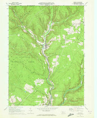
1969 Map of Wilcox
USGS Topo · Published 1972About this map
Allegheny National Forest covers much of this landscape, where the West Branch Clarion River and East Branch Clarion River meet to form the Clarion River proper. The settlement of Wilcox occupies this river junction, serving as a focal point for the region's resource extraction and transport. Extensive energy development is evident across the Nansen Oil and Gas Field and Mill Creek Oil and Gas Field, while a Strip Mine near Rasselas points to the area's coal interests. Rail infrastructure is well-established, with the Penn Central and Ohio and Baltimore lines navigating the valleys. Public lands dominate the southern and western portions, including the Bendigo State Park and No 25 Game Lands, showing the mix of industrial land use and conservation characteristic of Elk County in the late 1960s.
Find a feature on this map
36 named features on this map. Tap any name to fly to it.
Don’t see what you’re looking for? This feature index may not catch every label — zoom into the map to look around manually.
Map Details
Editions of this 1969 Wilcox Map
3 editions found
Other maps of this area

1934 · Kane
USGS Topo · 1:48,000

1935 · Mt. Jewett
USGS Topo · 1:48,000

1939 · Kane
USGS Topo · 1:62,500

1940 · Hallton
USGS Topo · 1:48,000

1940 · Mt. Jewett
USGS Topo · 1:62,500

1941 · Ridgway
USGS Topo · 1:62,500

1943 · Hallton
USGS Topo · 1:62,500

1944 · Ridgway
USGS Topo · 1:62,500

1957 · Warren
USGS Topo · 1:250,000

1958 · Warren
USGS Topo · 1:250,000
Featured Places
- Saint Marys, PA
- Wilcox, Jones Township
- Tambine, Jones Township
- Wetmore Township, PA
- Ridgway Township, PA