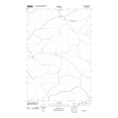
2011 Map of Wilcox
USGS Topo · Published 2011About this map
The settlement of Wilcox lies at the heart of this agricultural landscape in the Palouse region, where the drainages of Union Flat Creek and Rebel Flat Creek converge. The terrain is defined by a dense network of coulees and seasonal streams, with names like Alkali Flat Creek and Goose Creek carving through the plateau. Local heritage is centered around long-established sites such as the Onecho Cemetery in the southwest and the Palouse Empire Fairgrounds to the north near Mockonema. Transport and infrastructure are represented by the Whitman County Memorial Airport and a grid of rural roads bearing family names, including Kammerzell Rd, Aeschliman Rd, and Nauert Rd. These labels reflect a legacy of land ownership and farming history that persists into the 21st century.
Find a feature on this map
31 named features on this map. Tap any name to fly to it.
Don’t see what you’re looking for? This feature index may not catch every label — zoom into the map to look around manually.
Map Details
Editions of this 2011 Wilcox Map
This is the sole edition of this map. No revisions or reprints were ever made.
Other maps of this area

1910 · Pullman
USGS Topo · 1:125,000

1950 · Penawawa
USGS Topo · 1:62,500

1950 · Endicott
USGS Topo · 1:62,500

1955 · Pullman
USGS Topo · 1:250,000

1958 · Pullman
USGS Topo · 1:250,000

1964 · Diamond
USGS Topo · 1:24,000

1964 · Colfax North
USGS Topo · 1:24,000

1964 · Wilcox
USGS Topo · 1:24,000

1964 · Colfax South
USGS Topo · 1:24,000

1964 · Ewartsville
USGS Topo · 1:24,000