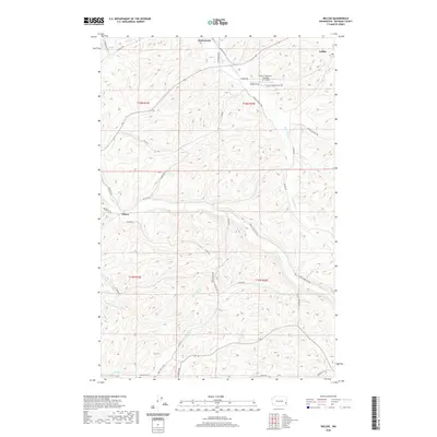
2020 Map of Wilcox
USGS Topo · Published 2020About this map
Wilcox and the surrounding agricultural uplands of Whitman County are defined by a complex network of seasonal creeks and coulees that drain toward the Snake River. The landscape is marked by small rural settlements like Onecho and Mockonema, connected by a web of named farm roads such as Almota Rd and Duncan Springs Rd. This 2020 survey illustrates the modern configuration of the Palouse region, where traditional land use meets specialized infrastructure like the Port of Whitman Business Air Center near Rebel Flat. Genealogists can locate the Onecho Cem in the southern portion of the map, while hydrologists can trace the branching tributaries of Union Flat Cr, Rebel Flat Cr, and Goose Cr as they cut through the plateau.
Find a feature on this map
41 named features on this map. Tap any name to fly to it.
Don’t see what you’re looking for? This feature index may not catch every label — zoom into the map to look around manually.
Map Details
Editions of this 2020 Wilcox Map
This is the sole edition of this map. No revisions or reprints were ever made.
Other maps of this area

1910 · Pullman
USGS Topo · 1:125,000

1950 · Penawawa
USGS Topo · 1:62,500

1950 · Endicott
USGS Topo · 1:62,500

1955 · Pullman
USGS Topo · 1:250,000

1958 · Pullman
USGS Topo · 1:250,000

1964 · Diamond
USGS Topo · 1:24,000

1964 · Colfax North
USGS Topo · 1:24,000

1964 · Wilcox
USGS Topo · 1:24,000

1964 · Colfax South
USGS Topo · 1:24,000

1964 · Ewartsville
USGS Topo · 1:24,000