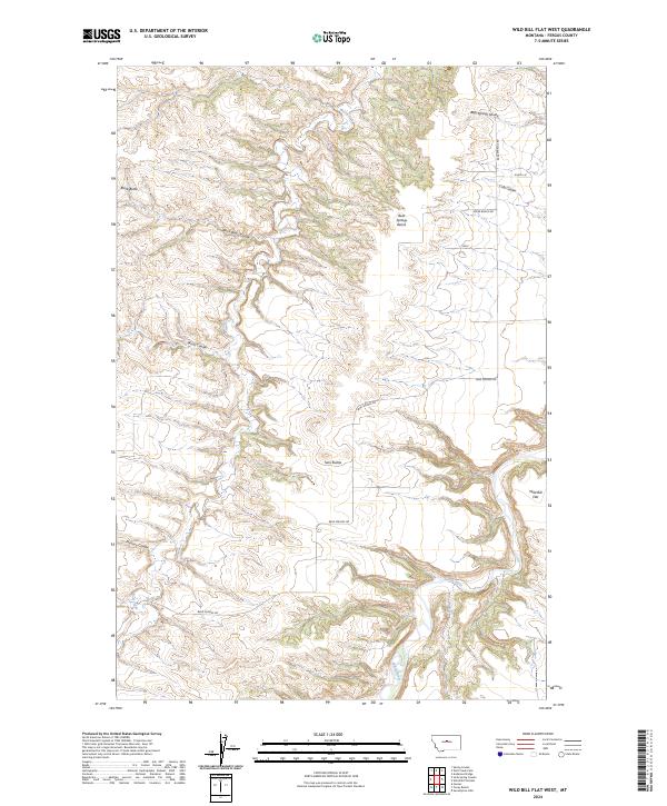
2024 Map of Wild Bill Flat West
USGS Topo · Published 2024About this map
The Judith River meanders through the southeastern corner of this Fergus County landscape, joined by Willow Creek as it carves through the undulating terrain. This 2024 map documents a topography defined by complex coulees and prominent high points, most notably Black Butte and the Twin Buttes. The high plains character is evident in the expansive Bear Springs Bench and Wild Bill Flat, areas that represent the traditional cattle ranching and dryland farming geography of central Montana.
Find a feature on this map
19 named features on this map. Tap any name to fly to it.
Don’t see what you’re looking for? This feature index may not catch every label — zoom into the map to look around manually.
Map Details
Editions of this 2024 Wild Bill Flat West Map
This is the sole edition of this map. No revisions or reprints were ever made.
Other maps of this area

1954 · Lewistown
USGS Topo · 1:250,000

1959 · Lewistown
USGS Topo · 1:250,000

1964 · Wolf Creek Falls
USGS Topo · 1:24,000

1964 · Anderson Bridge
USGS Topo · 1:24,000

1964 · Spring Coulee
USGS Topo · 1:24,000
1978 · Soda Spring Coulee
USGS Topo · 1:24,000

1978 · Wild Bill Flat West
USGS Topo · 1:24,000

1978 · Toney Bench
USGS Topo · 1:24,000
1978 · Hoosac
USGS Topo · 1:24,000

1978 · Seventytwo Hills
USGS Topo · 1:24,000