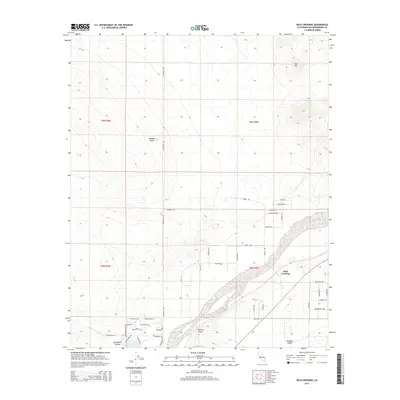
2015 Map of Wild Crossing
USGS Topo · Published 2015About this map
Wild Crossing and the prominent Point of Rocks define this reach of the Mojave Desert in San Bernardino County. The landscape is marked by the wide, sandy bed of the Mojave River as it passes east of North Lake and the residential clusters of Brisbane Valley. This area serves as a transit corridor where modern thoroughfares like Helen Dale Rd intersect with historic routes and tracks, including the Santa Fe Trl and Mojave Trl. The topography rises sharply to the northeast at Iron Mtn, while the southwestern section is dissected by drainage features such as Buckthorn Canyon and Buckthorn Wash. A network of localized trails and named roads, from Bonanza Trl to Wagonwheel Trl, indicates a mix of recreational access and rural development characteristic of the high desert during the early 21st century.
Find a feature on this map
47 named features on this map. Tap any name to fly to it.
Don’t see what you’re looking for? This feature index may not catch every label — zoom into the map to look around manually.
Map Details
Editions of this 2015 Wild Crossing Map
This is the sole edition of this map. No revisions or reprints were ever made.
Other maps of this area

1932 · Barstow
USGS Topo · 1:125,000

1934 · Barstow
USGS Topo · 1:125,000

1953 · San Bernardino
USGS Topo · 1:250,000

1956 · San Bernardino
USGS Topo · 1:250,000

1956 · Hawes
USGS Topo · 1:62,500
1956 · Victorville NW
USGS Topo · 1:24,000

1956 · Barstow
USGS Topo · 1:62,500

1956 · Helendale
USGS Topo · 1:24,000
1956 · Victorville
USGS Topo · 1:62,500

1957 · Apple Valley
USGS Topo · 1:62,500