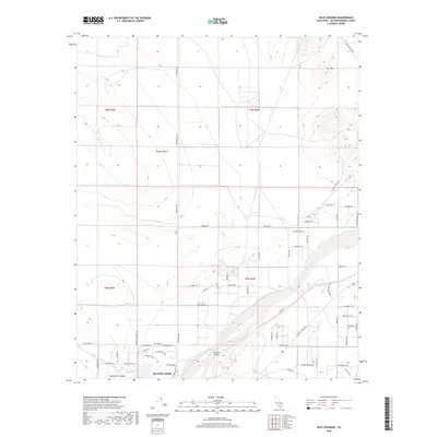
2018 Map of Wild Crossing
USGS Topo · Published 2018About this map
The Mojave River carves through the arid landscape of the Mojave Desert in this portion of San Bernardino County. The riverbed, often a dry wash in this environment, is flanked by distinctive geological formations such as the Point of Rocks and the elevation of Iron Mtn. To the west, the drainage of Buckthorn Canyon and Buckthorn Wash highlights the seasonal watercourses that define the local topography.
Find a feature on this map
58 named features on this map. Tap any name to fly to it.
Don’t see what you’re looking for? This feature index may not catch every label — zoom into the map to look around manually.
Map Details
Editions of this 2018 Wild Crossing Map
This is the sole edition of this map. No revisions or reprints were ever made.
Other maps of this area

1932 · Barstow
USGS Topo · 1:125,000

1934 · Barstow
USGS Topo · 1:125,000

1953 · San Bernardino
USGS Topo · 1:250,000

1956 · San Bernardino
USGS Topo · 1:250,000

1956 · Hawes
USGS Topo · 1:62,500
1956 · Victorville NW
USGS Topo · 1:24,000

1956 · Barstow
USGS Topo · 1:62,500

1956 · Helendale
USGS Topo · 1:24,000
1956 · Victorville
USGS Topo · 1:62,500

1957 · Apple Valley
USGS Topo · 1:62,500