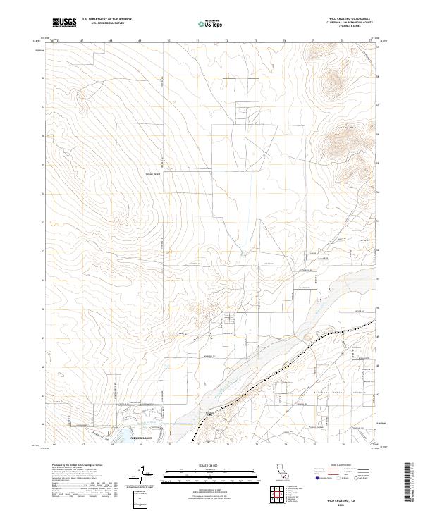
2021 Map of Wild Crossing
USGS Topo · Published 2021About this map
Silver Lakes and the winding course of the Mojave River anchor this desert landscape, where water has long dictated the path of travel and settlement. The river corridor is flanked by the Brisbane Valley and punctuated by the distinctive Point of Rocks, a geologic landmark that has served as a navigational waypoint for centuries. To the northeast, the terrain rises toward Iron Mtn, while the valley floor is etched with the drainage of Buckthorn Wash and Buckthorn Canyon.
Find a feature on this map
97 named features on this map. Tap any name to fly to it.
Don’t see what you’re looking for? This feature index may not catch every label — zoom into the map to look around manually.
Map Details
Editions of this 2021 Wild Crossing Map
This is the sole edition of this map. No revisions or reprints were ever made.
Other maps of this area

1932 · Barstow
USGS Topo · 1:125,000

1934 · Barstow
USGS Topo · 1:125,000

1953 · San Bernardino
USGS Topo · 1:250,000

1956 · San Bernardino
USGS Topo · 1:250,000

1956 · Hawes
USGS Topo · 1:62,500
1956 · Victorville NW
USGS Topo · 1:24,000

1956 · Barstow
USGS Topo · 1:62,500

1956 · Helendale
USGS Topo · 1:24,000
1956 · Victorville
USGS Topo · 1:62,500

1957 · Apple Valley
USGS Topo · 1:62,500