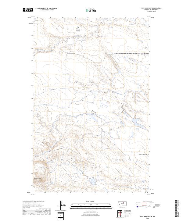
2024 Map of Wild Horse Butte
USGS Topo · Published 2024About this map
Fort Belknap Agency occupies the northern reaches of this Montana landscape, situated near the winding course of White Bear Creek. The terrain is defined by a network of drainage systems including Fifteenmile Creek and Peoples Creek, which flows past the Old-Woman Reservoir. These water sources were vital for the development of the region, supporting the local agency and surrounding ranching or agricultural efforts.
Find a feature on this map
13 named features on this map. Tap any name to fly to it.
Don’t see what you’re looking for? This feature index may not catch every label — zoom into the map to look around manually.
Map Details
Editions of this 2024 Wild Horse Butte Map
This is the sole edition of this map. No revisions or reprints were ever made.
Other maps of this area

1953 · Havre
USGS Topo · 1:250,000

1957 · Havre
USGS Topo · 1:250,000

1958 · Havre
USGS Topo · 1:250,000

1964 · Threemile Reservoir
USGS Topo · 1:24,000
1964 · Fort Belknap Agency
USGS Topo · 1:24,000
1964 · Savoy
USGS Topo · 1:24,000
1971 · Fort Belknap Agency SE
USGS Topo · 1:24,000

1971 · Lodge Pole NW
USGS Topo · 1:24,000

1971 · Lodge Pole NE
USGS Topo · 1:24,000
1971 · Lake Seventeen NE
USGS Topo · 1:24,000