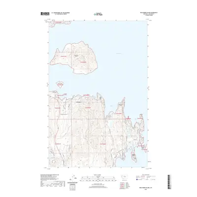
2020 Map of Wild Horse Island
USGS Topo · Published 2020About this map
Wild Horse Island dominates the northern waters of this Flathead Lake landscape, showcasing the topographic complexity of the largest natural freshwater lake in the region. The map reveals a shoreline defined by numerous indentations and geographical markers, from the quiet waters of White Swan Bay and Indian Bay to the rocky protrusion of Matterhorn Point. The settlement of Lindisfarne is situated on the mainland across from the smaller Melita Island and Dream Island, indicating a localized pattern of development that follows the water's edge.
Find a feature on this map
30 named features on this map. Tap any name to fly to it.
Don’t see what you’re looking for? This feature index may not catch every label — zoom into the map to look around manually.
Map Details
Editions of this 2020 Wild Horse Island Map
This is the sole edition of this map. No revisions or reprints were ever made.
Other maps of this area

1920 · Flathead Lake
USGS Topo · 1:125,000

1956 · Wallace
USGS Topo · 1:250,000

1960 · Wallace
USGS Topo · 1:250,000

1964 · Bull Island
USGS Topo · 1:24,000

1964 · Buffalo Bridge
USGS Topo · 1:24,000

1964 · Wild Horse Island
USGS Topo · 1:24,000

1964 · East Bay
USGS Topo · 1:24,000
1964 · Rollins
USGS Topo · 1:24,000

1964 · Elmo
USGS Topo · 1:24,000

1964 · Polson
USGS Topo · 1:24,000