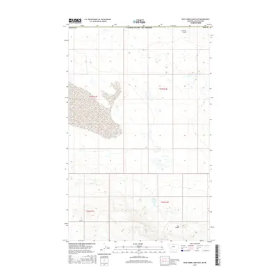
2017 Map of Wild Horse Lake East
USGS Topo · Published 2017About this map
Creedman Coulee and numerous small water catchments define this high plains landscape along the northern border of Hill County, Montana. The terrain is characterized by a series of coulees and depressions, with Dog Coulee cutting through the southeastern portion of the quadrangle. Human infrastructure is notably sparse in this 2017 study, with Base Rd providing one of the few primary access points across the southern sections. Water management is a central feature of the local geography, evidenced by the presence of the U N Reservoir. This map documents a transitional prairie environment where natural drainage patterns and small-scale water storage systems are essential to the land's utility near the international boundary with Canada.
Find a feature on this map
11 named features on this map. Tap any name to fly to it.
Don’t see what you’re looking for? This feature index may not catch every label — zoom into the map to look around manually.
Map Details
Editions of this 2017 Wild Horse Lake East Map
This is the sole edition of this map. No revisions or reprints were ever made.
Other maps of this area

1912 · Thibedeau Lake
USGS Topo · 1:125,000

1920 · Gildford
USGS Topo · 1:125,000

1943 · Gildford
USGS Topo · 1:125,000

1953 · Havre
USGS Topo · 1:250,000

1954 · Shelby
USGS Topo · 1:250,000

1957 · Havre
USGS Topo · 1:250,000

1958 · Shelby
USGS Topo · 1:250,000

1958 · Havre
USGS Topo · 1:250,000

1972 · Hilldale Colony
USGS Topo · 1:24,000
1972 · Wild Horse Lake West
USGS Topo · 1:24,000