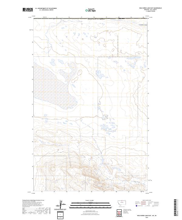
2024 Map of Wild Horse Lake East
USGS Topo · Published 2024About this map
The high plains of Hill County along the northern border of the United States of America are defined by the subtle drainage patterns of the northern prairie. Creedman Coulee cuts through the northeast corner, while the southern reaches of the quadrangle are marked by the rugged indentations of Dog Coulee. This 2024 survey captures a landscape dominated by township and range boundaries, including t37n r13e and t36n r14e, illustrating the persistent grid of the Public Land Survey System in this remote part of Montana. Water management is a central feature of the terrain, exemplified by the U N Reservoir, which serves as a critical point for local land use in an otherwise arid expanse of northern rangeland.
Find a feature on this map
8 named features on this map. Tap any name to fly to it.
Don’t see what you’re looking for? This feature index may not catch every label — zoom into the map to look around manually.
Map Details
Editions of this 2024 Wild Horse Lake East Map
This is the sole edition of this map. No revisions or reprints were ever made.
Other maps of this area

1912 · Thibedeau Lake
USGS Topo · 1:125,000

1920 · Gildford
USGS Topo · 1:125,000

1943 · Gildford
USGS Topo · 1:125,000

1953 · Havre
USGS Topo · 1:250,000

1954 · Shelby
USGS Topo · 1:250,000

1957 · Havre
USGS Topo · 1:250,000

1958 · Shelby
USGS Topo · 1:250,000

1958 · Havre
USGS Topo · 1:250,000

1972 · Hilldale Colony
USGS Topo · 1:24,000
1972 · Wild Horse Lake West
USGS Topo · 1:24,000