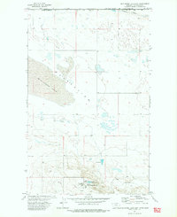
1972 Map of Wild Horse Lake East
USGS Topo · Published 1975About this map
Havre Air Force Station anchors the southern portion of this northern Montana landscape, situated just south of the international boundary between the United States and Canada. The area is characterized by the expansive Wild Horse Lake (Depression), a vast basin that dominates the central terrain. This 1970s survey captures a transition point in the Cold War-era military presence in Hill County, documenting the facility alongside local civilian landmarks like the Lakeview Sch.
Find a feature on this map
13 named features on this map. Tap any name to fly to it.
Don’t see what you’re looking for? This feature index may not catch every label — zoom into the map to look around manually.
Map Details
Editions of this 1972 Wild Horse Lake East Map
This is the sole edition of this map. No revisions or reprints were ever made.
Other maps of this area

1912 · Thibedeau Lake
USGS Topo · 1:125,000

1920 · Gildford
USGS Topo · 1:125,000

1943 · Gildford
USGS Topo · 1:125,000

1953 · Havre
USGS Topo · 1:250,000

1954 · Shelby
USGS Topo · 1:250,000

1957 · Havre
USGS Topo · 1:250,000

1958 · Shelby
USGS Topo · 1:250,000

1958 · Havre
USGS Topo · 1:250,000

1972 · Hilldale Colony
USGS Topo · 1:24,000
1972 · Wild Horse Lake West
USGS Topo · 1:24,000