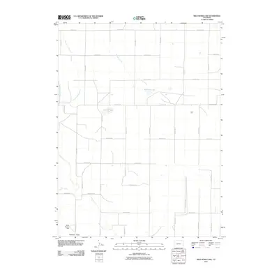
2010 Map of Wild Horse Lake
USGS Topo · Published 2010About this map
Wild Horse Lake and the seasonally shifting Dry Wild Horse Lake anchor this portion of the Logan County high plains, a landscape defined by an extensive grid of section-line roads and water management systems. The terrain transitions from the low-lying basins of Yenter Pool toward the more pronounced topography of the Pawnee Hills in the southwest corner. This area is heavily influenced by the drainage patterns of Wild Horse Creek and the bifurcated channels of Pawnee Inlet Number 1 and Pawnee Inlet Number 2.
Find a feature on this map
30 named features on this map. Tap any name to fly to it.
Don’t see what you’re looking for? This feature index may not catch every label — zoom into the map to look around manually.
Map Details
Editions of this 2010 Wild Horse Lake Map
This is the sole edition of this map. No revisions or reprints were ever made.
Other maps of this area

1951 · Willard
USGS Topo · 1:24,000

1951 · Wild Horse Lake
USGS Topo · 1:24,000

1951 · Atwood NE
USGS Topo · 1:24,000

1951 · Atwood
USGS Topo · 1:24,000

1954 · Sterling
USGS Topo · 1:250,000

1958 · Sterling
USGS Topo · 1:250,000

1977 · Stoneham NE
USGS Topo · 1:24,000

1977 · Avalo SE
USGS Topo · 1:24,000
1978 · North Sterling Reservoir
USGS Topo · 1:24,000
1978 · Stoneham SE
USGS Topo · 1:24,000