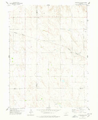
1978 Map of Stoneham SE
USGS Topo · Published 1978About this map
Logan County ranching and energy extraction lands dominate this late-1970s landscape, characterized by the wide, intermittent path of Sand Creek cutting diagonally across the terrain. The presence of the Burlington Northern railroad corridor through the central region underscores the vital role of heavy rail in moving the agricultural and petroleum products of the High Plains. While the surface is marked by intermittent water sources like a lone Spring, the subsurface is active with several Oil Wells and individual Well sites, indicating the era's ongoing development of rural energy resources. The map also captures the precise intersection of several county boundaries, including the Weld, Morgan, and Logan county lines, providing a detailed record of land jurisdiction and surveying in this sparsely populated stretch of Colorado.
Find a feature on this map
10 named features on this map. Tap any name to fly to it.
Don’t see what you’re looking for? This feature index may not catch every label — zoom into the map to look around manually.
Map Details
Editions of this 1978 Stoneham SE Map
This is the sole edition of this map. No revisions or reprints were ever made.
Other maps of this area

1951 · Dead Horse Springs
USGS Topo · 1:24,000

1951 · Willard
USGS Topo · 1:24,000

1951 · Messex
USGS Topo · 1:24,000

1951 · Antelope Springs
USGS Topo · 1:24,000

1951 · Wild Horse Lake
USGS Topo · 1:24,000

1954 · Sterling
USGS Topo · 1:250,000

1958 · Sterling
USGS Topo · 1:250,000

1971 · Messex
USGS Topo · 1:24,000

1977 · Stoneham
USGS Topo · 1:24,000

1977 · Stoneham NE
USGS Topo · 1:24,000