
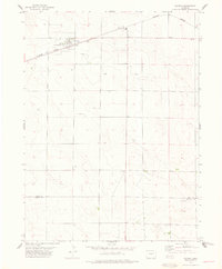
1977 Map of Stoneham
USGS Topo · Published 1978About this map
Stoneham serves as the primary hub of this northeastern Colorado landscape, situated along the Burlington Northern railroad line during the late 1970s. The town's community infrastructure is anchored by the Rodeo Ground and the Prairie View Cem, reflecting a classic High Plains settlement pattern where rail transport and local agriculture intersect. The terrain is defined by undulating contours and scattered resources, with several instances of an Oil Well indicating the area's energy production history.
Find a feature on this map
8 named features on this map. Tap any name to fly to it.
Don’t see what you’re looking for? This feature index may not catch every label — zoom into the map to look around manually.
Map Details
Editions of this 1977 Stoneham Map
This is the sole edition of this map. No revisions or reprints were ever made.
Other maps of this area

1951 · Dead Horse Springs
USGS Topo · 1:24,000

1951 · Antelope Springs
USGS Topo · 1:24,000

1951 · Peace Valley School
USGS Topo · 1:24,000

1954 · Sterling
USGS Topo · 1:250,000

1958 · Sterling
USGS Topo · 1:250,000

1977 · Stoneham NE
USGS Topo · 1:24,000

1977 · Raymer NE
USGS Topo · 1:24,000

1978 · Stoneham NW
USGS Topo · 1:24,000
1978 · Raymer
USGS Topo · 1:24,000
1978 · Stoneham SE
USGS Topo · 1:24,000