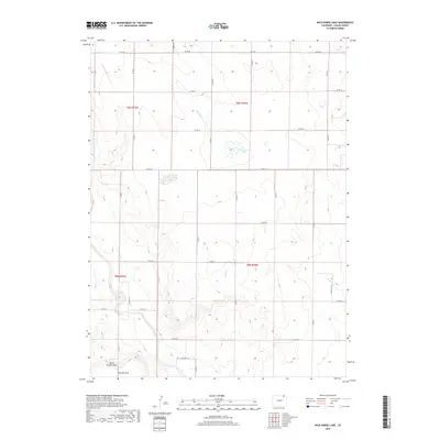
2019 Map of Wild Horse Lake
USGS Topo · Published 2019About this map
Wild Horse Lake sits as a central seasonal water body within this high plains landscape of Logan County. The terrain is defined by a network of ephemeral drainages including Wild Horse Cr and Sand Cr, which carve through the shortgrass prairie. In the southwestern corner, the elevation rises toward the Pawnee Hills, where North Pawnee Pass provides a distinct geographic landmark against the otherwise steady township and range grid. This modern survey illustrates the persistent agricultural and ranching layout of the region, where a geometric web of county roads such as Co RD 44 and Co RD 30 provides the primary infrastructure for traversing the open country. The water management of the area is further evidenced by the Pawnee Inlet Number 1 and Pawnee Inlet Number 2, which channel vital resources toward Pawnee Creek.
Find a feature on this map
23 named features on this map. Tap any name to fly to it.
Don’t see what you’re looking for? This feature index may not catch every label — zoom into the map to look around manually.
Map Details
Editions of this 2019 Wild Horse Lake Map
This is the sole edition of this map. No revisions or reprints were ever made.
Other maps of this area

1951 · Willard
USGS Topo · 1:24,000

1951 · Wild Horse Lake
USGS Topo · 1:24,000

1951 · Atwood NE
USGS Topo · 1:24,000

1951 · Atwood
USGS Topo · 1:24,000

1954 · Sterling
USGS Topo · 1:250,000

1958 · Sterling
USGS Topo · 1:250,000

1977 · Stoneham NE
USGS Topo · 1:24,000

1977 · Avalo SE
USGS Topo · 1:24,000
1978 · North Sterling Reservoir
USGS Topo · 1:24,000
1978 · Stoneham SE
USGS Topo · 1:24,000