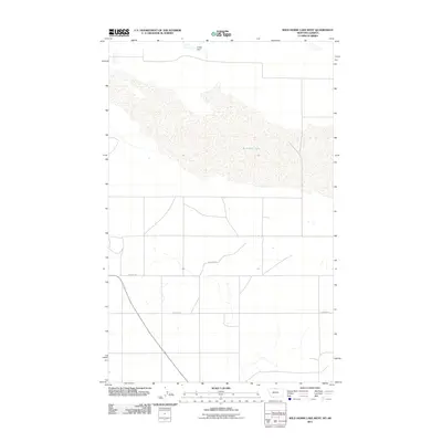
2011 Map of Wild Horse Lake West
USGS Topo · Published 2011About this map
Wild Horse Lake dominates this northern frontier along the Montana-Alberta border, where the high plains transition into the international boundary. The 2011 survey by the U.S. Geological Survey captures the specialized infrastructure of this remote arid landscape, featuring the Fuago Dam situated at the northern edge of the sheet. The area is defined by a sparse network of section-line roads and local routes including Hi Grade Rd and Simpson Rd, which serve the expansive agricultural and grazing lands. This map is particularly valuable for documenting the specific drainage and water management features of Hill County, reflecting the challenges of settlement and land use in the semi-arid northern plains.
Find a feature on this map
4 named features on this map. Tap any name to fly to it.
Don’t see what you’re looking for? This feature index may not catch every label — zoom into the map to look around manually.
Map Details
Editions of this 2011 Wild Horse Lake West Map
This is the sole edition of this map. No revisions or reprints were ever made.
Other maps of this area

1912 · Thibedeau Lake
USGS Topo · 1:125,000

1920 · Gildford
USGS Topo · 1:125,000

1943 · Gildford
USGS Topo · 1:125,000

1953 · Havre
USGS Topo · 1:250,000

1954 · Shelby
USGS Topo · 1:250,000

1957 · Havre
USGS Topo · 1:250,000

1958 · Shelby
USGS Topo · 1:250,000

1958 · Havre
USGS Topo · 1:250,000
1972 · Wild Horse Lake West
USGS Topo · 1:24,000
1972 · Cottonwood
USGS Topo · 1:24,000