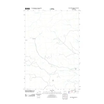
2011 Map of Wild Horse Parks
USGS Topo · Published 2011About this map
Wild Horse Parks defines this corner of Granite County, where a complex network of drainage basins and gulches shapes the high-country landscape. Water management is a central theme of the terrain, as seen at the Manley Number 1 Dam situated along the lower reaches of Douglas Creek. This waterway serves as a primary geographic spine for the area, roughly followed by Douglas Creek Rd as it moves through the mountains.
Find a feature on this map
14 named features on this map. Tap any name to fly to it.
Don’t see what you’re looking for? This feature index may not catch every label — zoom into the map to look around manually.
Map Details
Editions of this 2011 Wild Horse Parks Map
This is the sole edition of this map. No revisions or reprints were ever made.
Other maps of this area

1919 · Drummond
USGS Topo · 1:125,000

1921 · Drummond
USGS Topo · 1:125,000

1947 · Butte
USGS Topo · 1:250,000

1958 · Butte
USGS Topo · 1:250,000

1958 · Drummond
USGS Topo · 1:62,500

1959 · Bearmouth
USGS Topo · 1:62,500

1960 · Butte
USGS Topo · 1:250,000

1962 · Butte
USGS Topo · 1:250,000
1965 · Chimney Lakes
USGS Topo · 1:24,000

1965 · Wild Horse Parks
USGS Topo · 1:24,000