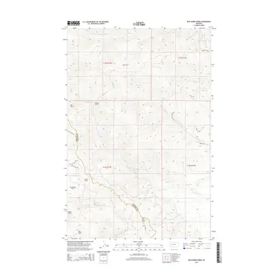
2014 Map of Wild Horse Parks
USGS Topo · Published 2014About this map
Wild Horse Parks and the high terrain of Fivemile Ridge define this landscape along the border of Granite and Powell counties. The topography is deeply incised by a network of drainages including Douglas Creek, Black Bear Creek, and Fivemile Creek, reflecting a remote mountain environment focused on water access and natural passage. Isolated water sources like Nelson Spring provided vital points of interest for early travelers and locals navigating the steep gulches.
Find a feature on this map
29 named features on this map. Tap any name to fly to it.
Don’t see what you’re looking for? This feature index may not catch every label — zoom into the map to look around manually.
Map Details
Editions of this 2014 Wild Horse Parks Map
This is the sole edition of this map. No revisions or reprints were ever made.
Other maps of this area

1919 · Drummond
USGS Topo · 1:125,000

1921 · Drummond
USGS Topo · 1:125,000

1947 · Butte
USGS Topo · 1:250,000

1958 · Butte
USGS Topo · 1:250,000

1958 · Drummond
USGS Topo · 1:62,500

1959 · Bearmouth
USGS Topo · 1:62,500

1960 · Butte
USGS Topo · 1:250,000

1962 · Butte
USGS Topo · 1:250,000
1965 · Chimney Lakes
USGS Topo · 1:24,000

1965 · Wild Horse Parks
USGS Topo · 1:24,000