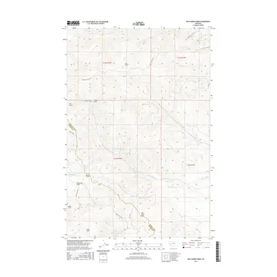
2017 Map of Wild Horse Parks
USGS Topo · Published 2017About this map
Wild Horse Parks and the surrounding drainage basins define this 2017 study of the mountainous border between Powell and Granite Counties. The landscape is dominated by a complex network of creeks and gulches, including the curiously named Yourname Cr and the more traditional Murray Cr. This map documents a high-country region where access is primarily via forest roads and fire routes, such as McElwain Fire Rd 2840 and Rattler Gulch Rd. The terrain is deeply incised, characterized by features like Wet Mulkey Gulch and Bilk Gulch. These named landmarks and water sources, such as Nelson Spring, provide essential reference points for land management and navigation in this portion of the Montana Rockies, illustrating the intersection of natural hydrology and modern cartography in a remote interior setting.
Find a feature on this map
29 named features on this map. Tap any name to fly to it.
Don’t see what you’re looking for? This feature index may not catch every label — zoom into the map to look around manually.
Map Details
Editions of this 2017 Wild Horse Parks Map
This is the sole edition of this map. No revisions or reprints were ever made.
Other maps of this area

1919 · Drummond
USGS Topo · 1:125,000

1921 · Drummond
USGS Topo · 1:125,000

1947 · Butte
USGS Topo · 1:250,000

1958 · Butte
USGS Topo · 1:250,000

1958 · Drummond
USGS Topo · 1:62,500

1959 · Bearmouth
USGS Topo · 1:62,500

1960 · Butte
USGS Topo · 1:250,000

1962 · Butte
USGS Topo · 1:250,000
1965 · Chimney Lakes
USGS Topo · 1:24,000

1965 · Wild Horse Parks
USGS Topo · 1:24,000