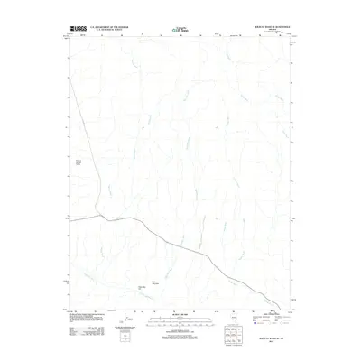
2012 Map of Wildcat Wash SE
USGS Topo · Published 2012About this map
The arid landscape of Clark County is defined here by an intricate network of drainage channels, most notably Wildcat Wash and Dead Man Wash, which carve through the high desert. To the west, the broad expanse of Coyote Spring Valley transitions into more elevated terrain near Table Mountain and Dead Man Hill. The primary corridor for travel follows the alignment of modern state routes and the legacy of Old Hwy 93, cutting diagonally across the quadrangle. Other significant waterways such as Pahranagat Wash, McKay Wash, and Muddy Wash illustrate the seasonal hydrology of the region, where Dry Gulch and Farrier Wash further reveal the complex topography of this desert environment during the early 21st century.
Find a feature on this map
11 named features on this map. Tap any name to fly to it.
Don’t see what you’re looking for? This feature index may not catch every label — zoom into the map to look around manually.
Map Details
Editions of this 2012 Wildcat Wash SE Map
This is the sole edition of this map. No revisions or reprints were ever made.
Other maps of this area

1886 · Saint Thomas
USGS Topo · 1:250,000

1893 · Saint Thomas
USGS Topo · 1:250,000

1954 · Las Vegas
USGS Topo · 1:250,000

1957 · Las Vegas
USGS Topo · 1:250,000

1958 · Arrow Canyon
USGS Topo · 1:62,500

1958 · Moapa
USGS Topo · 1:62,500

1959 · Las Vegas
USGS Topo · 1:250,000

1962 · Las Vegas
USGS Topo · 1:250,000

1969 · Farrier
USGS Topo · 1:24,000
1969 · Wildcat Wash NE
USGS Topo · 1:24,000