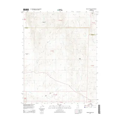
2014 Map of Wildcat Wash SE
USGS Topo · Published 2014About this map
Moapa Town sits at the heart of this desert landscape, where the drainage systems of southern Nevada converge near the Lincoln and Clark County line. The terrain is defined by complex alluvial fans and seasonal watercourses, including Wildcat Wash and McKay Wash, which carve paths toward the Muddy Wash basin. This 2014 survey reveals a transition from the high ridges of the Meadow Valley Mountains to the broad expanse of Coyote Spring Valley in the west.
Find a feature on this map
22 named features on this map. Tap any name to fly to it.
Don’t see what you’re looking for? This feature index may not catch every label — zoom into the map to look around manually.
Map Details
Editions of this 2014 Wildcat Wash SE Map
This is the sole edition of this map. No revisions or reprints were ever made.
Other maps of this area

1886 · Saint Thomas
USGS Topo · 1:250,000

1893 · Saint Thomas
USGS Topo · 1:250,000

1954 · Las Vegas
USGS Topo · 1:250,000

1957 · Las Vegas
USGS Topo · 1:250,000

1958 · Arrow Canyon
USGS Topo · 1:62,500

1958 · Moapa
USGS Topo · 1:62,500

1959 · Las Vegas
USGS Topo · 1:250,000

1962 · Las Vegas
USGS Topo · 1:250,000

1969 · Farrier
USGS Topo · 1:24,000
1969 · Wildcat Wash NE
USGS Topo · 1:24,000