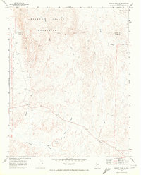
1969 Map of Wildcat Wash SE
USGS Topo · Published 1972About this map
Meadow Valley Mountains and the Coyote Spring Valley dominate this late-1960s landscape along the Indefinite Boundary between Lincoln and Clark counties. The terrain is defined by a series of ephemeral watercourses including Wildcat Wash, Dead Man Wash, and McKay Wash, which carve through the high desert floor toward landmarks like Table Mountain and Dead Man Hill.
Find a feature on this map
17 named features on this map. Tap any name to fly to it.
Don’t see what you’re looking for? This feature index may not catch every label — zoom into the map to look around manually.
Map Details
Editions of this 1969 Wildcat Wash SE Map
2 editions found
Other maps of this area

1886 · Saint Thomas
USGS Topo · 1:250,000

1893 · Saint Thomas
USGS Topo · 1:250,000

1954 · Las Vegas
USGS Topo · 1:250,000

1957 · Las Vegas
USGS Topo · 1:250,000

1958 · Arrow Canyon
USGS Topo · 1:62,500

1958 · Moapa
USGS Topo · 1:62,500

1959 · Las Vegas
USGS Topo · 1:250,000

1962 · Las Vegas
USGS Topo · 1:250,000

1969 · Farrier
USGS Topo · 1:24,000
1969 · Wildcat Wash NE
USGS Topo · 1:24,000