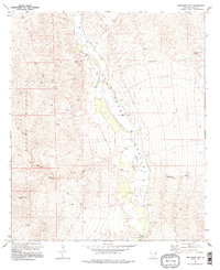
1973 Map of Wildhorse Mtn
USGS Topo · Published 1996About this map
The San Pedro Valley serves as a vital corridor through the arid landscape of Cochise County, as seen in this early 1970s survey. The San Pedro River winds through the center of the sheet, supported by a network of drainage features including Kelsey Canyon, Palomas Wash, and Redrock Creek. This desert riparian environment is marked by numerous water sources critical for ranching and survival, such as Diamond E Spring, Palomas Spring, and a high concentration of wells like Well 3235 and Well 3305 along the valley floor.
Find a feature on this map
30 named features on this map. Tap any name to fly to it.
Don’t see what you’re looking for? This feature index may not catch every label — zoom into the map to look around manually.
Map Details
Editions of this 1973 Wildhorse Mtn Map
2 editions found
Other maps of this area

1943 · Dragoon
USGS Topo · 1:62,500

1943 · Winchester Mts.
USGS Topo · 1:62,500

1945 · Redington
USGS Topo · 1:62,500

1945 · Winchester Mts.
USGS Topo · 1:62,500

1945 · Happy Valley
USGS Topo · 1:62,500

1956 · Tucson
USGS Topo · 1:250,000

1957 · Redington
USGS Topo · 1:62,500

1957 · Winchester Mts.
USGS Topo · 1:62,500

1958 · Tucson
USGS Topo · 1:250,000

1958 · Happy Valley
USGS Topo · 1:62,500