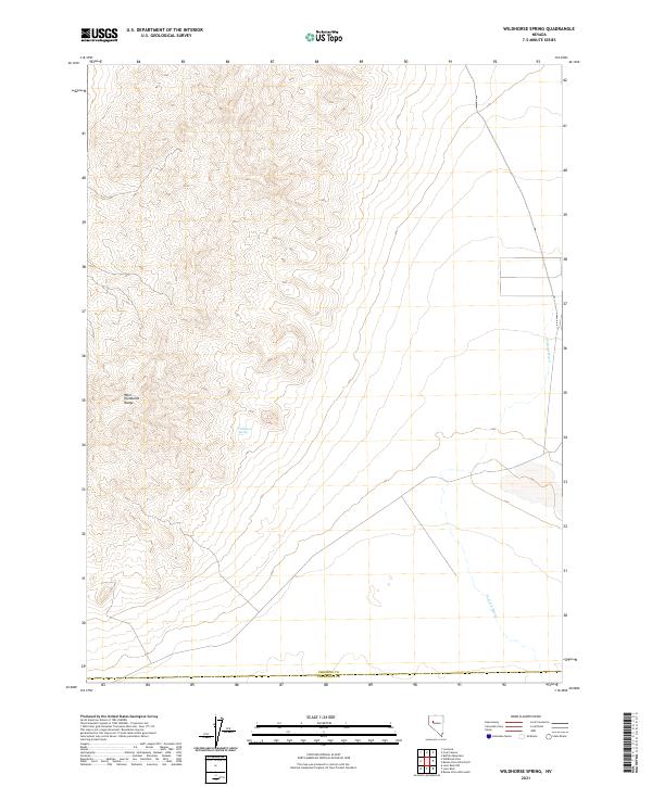
2021 Map of Wildhorse Spring
USGS Topo · Published 2021About this map
The West Humboldt Range dominates this landscape, rising above the arid basins of western Nevada. The map details a high-elevation transition where steep ridges give way to alluvial fans and desert floor. A critical water source in this dry environment, Wildhorse Spring is tucked into a canyon at the range's eastern edge, serving as a primary landmark for historical travel and grazing in the region. The drainage patterns of the Packard Wash carve through the eastern half of the quadrangle, illustrating the natural watercourses that define the local topography. This 2021 survey also marks the political boundary of Pershing Co Churchill Co along its southern edge, providing a precise look at the township and range survey lines that govern land division in the Great Basin.
Find a feature on this map
8 named features on this map. Tap any name to fly to it.
Don’t see what you’re looking for? This feature index may not catch every label — zoom into the map to look around manually.
Map Details
Editions of this 2021 Wildhorse Spring Map
This is the sole edition of this map. No revisions or reprints were ever made.
Other maps of this area

1908 · Carson Sink
USGS Topo · 1:250,000

1910 · Carson Sink
USGS Topo · 1:250,000

1931 · Lovelock
USGS Topo · 1:250,000

1935 · Lovelock
USGS Topo · 1:250,000

1954 · Buffalo Mtn
USGS Topo · 1:62,500

1955 · Lovelock
USGS Topo · 1:250,000

1956 · Lovelock
USGS Topo · 1:62,500

1957 · Reno
USGS Topo · 1:250,000

1959 · Lovelock
USGS Topo · 1:250,000

1959 · Reno
USGS Topo · 1:250,000