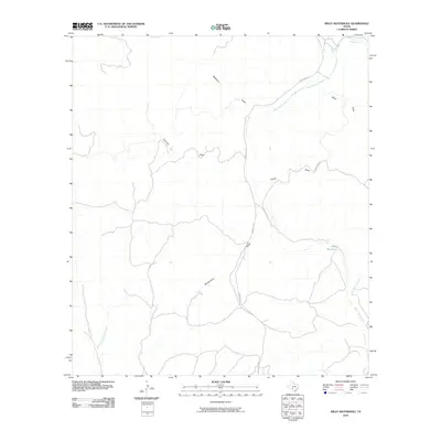
2010 Map of Wiley Waterhole
USGS Topo · Published 2010About this map
Wiley Waterhole sits at a critical junction of Edwards County drainage, where the intermittent channel of the West Nueces River carves through the Texas Hill Country. This 2010 survey illustrates the complex network of draws and arroyos that define the local hydrology, such as Newberry Draw and Government Draw, which serve as vital conduits for seasonal runoff. The primary transportation artery, Ranch Rd 674, follows the natural contours of the river valley, providing access to remote ranching properties and landmarks like Family Draw. Water features such as Bluff Creek and Cherry Creek highlight the reliance on specific waterholes in this arid landscape. The map provides a precise layout of rural roads, including Cedar Creek Rd, and topographic variations from Fourmile Draw to the East Fork Sycamore Creek, revealing the spatial relationship between limited water resources and regional access routes.
Find a feature on this map
12 named features on this map. Tap any name to fly to it.
Don’t see what you’re looking for? This feature index may not catch every label — zoom into the map to look around manually.
Map Details
Editions of this 2010 Wiley Waterhole Map
This is the sole edition of this map. No revisions or reprints were ever made.
Other maps of this area

1893 · Nueces
USGS Topo · 1:125,000

1896 · Nueces
USGS Topo · 1:125,000

1943 · Carta Valley
USGS Topo · 1:62,500

1944 · Flat Rock
USGS Topo · 1:62,500

1944 · Indian Creek
USGS Topo · 1:62,500

1944 · Indian Mountain
USGS Topo · 1:62,500

1958 · Del Rio
USGS Topo · 1:250,000

1964 · Del Rio
USGS Topo · 1:250,000
1967 · Indian Mountain
USGS Topo · 1:24,000
1974 · Twomile Draw
USGS Topo · 1:24,000