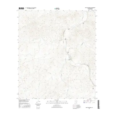
2016 Map of Wiley Waterhole
USGS Topo · Published 2016About this map
The W Nueces River carves a winding path through this portion of Edwards County, defining a landscape of deep drainage channels and water catchment points. This modern topographic study reveals a terrain shaped by seasonal hydrology, where numerous named features such as Newberry Draw, Fourmile Draw, and Government Draw converge toward the river valley. The presence of the Wiley Waterhole in the southeastern quadrant serves as a critical geographic marker in this arid region, where water sources often dictated land use and ranching boundaries.
Find a feature on this map
13 named features on this map. Tap any name to fly to it.
Don’t see what you’re looking for? This feature index may not catch every label — zoom into the map to look around manually.
Map Details
Editions of this 2016 Wiley Waterhole Map
This is the sole edition of this map. No revisions or reprints were ever made.
Other maps of this area

1893 · Nueces
USGS Topo · 1:125,000

1896 · Nueces
USGS Topo · 1:125,000

1943 · Carta Valley
USGS Topo · 1:62,500

1944 · Flat Rock
USGS Topo · 1:62,500

1944 · Indian Creek
USGS Topo · 1:62,500

1944 · Indian Mountain
USGS Topo · 1:62,500

1958 · Del Rio
USGS Topo · 1:250,000

1964 · Del Rio
USGS Topo · 1:250,000
1967 · Indian Mountain
USGS Topo · 1:24,000
1974 · Twomile Draw
USGS Topo · 1:24,000