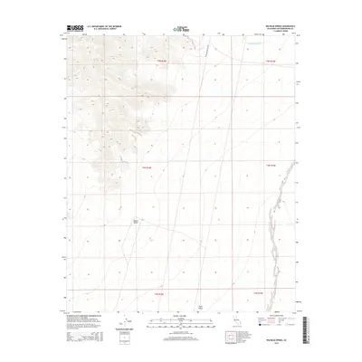
2015 Map of Wilhelm Spring
USGS Topo · Published 2015About this map
Wilhelm Spring provides a critical water point in this high-desert landscape within the eastern Mojave Desert. The map illustrates a stark environment defined by drainage patterns and arid-land navigation, where the Mojave Heritage Trl cuts across the northern terrain. This trail alignment reflects the long history of travel through the region, following established paths between scarce resources. To the southeast, the terrain opens into Ward Valley, while the seasonal hydrology of the area is marked by the extensive courses of Homer Wash and Painted Rock Wash. The survey precisely documents the elevation contours and township boundaries, capturing the spatial relationship between these intermittent water features and the rugged topographic breaks that characterize this portion of San Bernardino County.
Find a feature on this map
12 named features on this map. Tap any name to fly to it.
Don’t see what you’re looking for? This feature index may not catch every label — zoom into the map to look around manually.
Map Details
Editions of this 2015 Wilhelm Spring Map
This is the sole edition of this map. No revisions or reprints were ever made.
Other maps of this area

1942 · Amboy
USGS Topo · 1:250,000

1943 · Center Hills
USGS Topo · 1:62,500

1943 · Amboy
USGS Topo · 1:250,000

1943 · Essex
USGS Topo · 1:62,500

1943 · Turtle Mts.
USGS Topo · 1:62,500

1954 · Needles
USGS Topo · 1:250,000

1954 · Turtle Mountains
USGS Topo · 1:62,500

1956 · Needles
USGS Topo · 1:250,000

1956 · Milligan
USGS Topo · 1:62,500

1956 · Essex
USGS Topo · 1:62,500