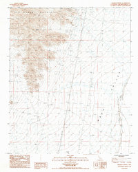
1985 Map of Wilhelm Spring
USGS Topo · Published 1985About this map
Old Woman Mountains rise sharply out of the eastern Mojave desert, defining the western edge of this mid-1980s topographic survey. The rugged topography is punctuated by historical mining activity, most notably at the Lucky Jim Mine and several nearby Prospects. These sites, tucked into the high ridges, suggest a history of exploration for mineral wealth in a landscape where water is the most precious resource, represented here by the namesake Wilhelm Spring.
Find a feature on this map
11 named features on this map. Tap any name to fly to it.
Don’t see what you’re looking for? This feature index may not catch every label — zoom into the map to look around manually.
Map Details
Editions of this 1985 Wilhelm Spring Map
This is the sole edition of this map. No revisions or reprints were ever made.
Other maps of this area

1942 · Amboy
USGS Topo · 1:250,000

1943 · Center Hills
USGS Topo · 1:62,500

1943 · Amboy
USGS Topo · 1:250,000

1943 · Essex
USGS Topo · 1:62,500

1943 · Turtle Mts.
USGS Topo · 1:62,500

1954 · Needles
USGS Topo · 1:250,000

1954 · Turtle Mountains
USGS Topo · 1:62,500

1956 · Needles
USGS Topo · 1:250,000

1956 · Milligan
USGS Topo · 1:62,500

1956 · Essex
USGS Topo · 1:62,500