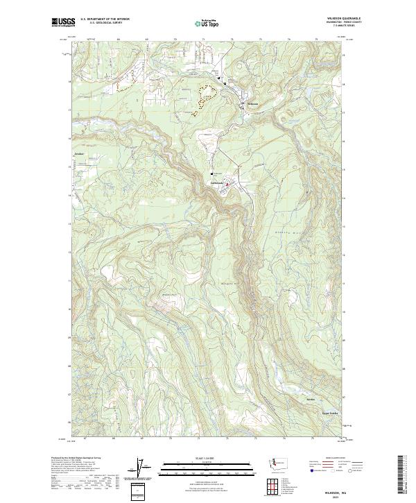
2023 Map of Wilkeson
USGS Topo · Published 2023About this map
Wilkeson and the coal-country settlements of the western Cascades are documented here along the steep terrain of the Carbon River valley. This 2023 survey identifies the lingering footprints of historical mining and timber communities, from the residential blocks of Carbonado to the remote sites of Fairfax and Upper Fairfax further south. The map provides precise locations for local genealogy and history, including the Wilkeson Town Cem, Wilkeson Catholic Cem, and the Carbonado Cem perched above the river gorge.
Find a feature on this map
74 named features on this map. Tap any name to fly to it.
Don’t see what you’re looking for? This feature index may not catch every label — zoom into the map to look around manually.
Map Details
Editions of this 2023 Wilkeson Map
This is the sole edition of this map. No revisions or reprints were ever made.
Other maps of this area

1897 · Tacoma
USGS Topo · 1:125,000

1900 · Tacoma
USGS Topo · 1:125,000

1913 · Cedar Lake
USGS Topo · 1:125,000

1924 · Mt Rainier
USGS Topo · 1:96,000

1928 · Mt Rainier
USGS Topo · 1:125,000

1937 · Eatonville
USGS Topo · 1:125,000

1942 · Lake Tapps
USGS Topo · 1:62,500

1944 · Lake Tapps
USGS Topo · 1:62,500

1950 · Yakima
USGS Topo · 1:250,000

1953 · Hoquiam
USGS Topo · 1:250,000