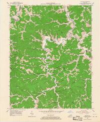
1953 Map of Willard
USGS Topo · Published 1967About this map
Willard stands at the confluence of the Little Fork and the Little Sandy River, serving as a central point in this mid-century topography where the borders of Carter, Lawrence, and Elliott counties meet. The landscape is defined by the extraction economy and rural community life, anchored by the E K Mines and its associated E K Mines Sch in the northeast. A network of small settlements like Beetle, Stephens, and Orr are linked by winding valley roads and numerous family-named landmarks.
Find a feature on this map
72 named features on this map. Tap any name to fly to it.
Don’t see what you’re looking for? This feature index may not catch every label — zoom into the map to look around manually.
Map Details
Editions of this 1953 Willard Map
2 editions found
Other maps of this area

1903 · Kenova
USGS Topo · 1:125,000

1904 · Kenova
USGS Topo · 1:125,000

1950 · Bruin
USGS Topo · 1:24,000

1950 · Grahn
USGS Topo · 1:24,000

1950 · Isonville
USGS Topo · 1:24,000

1953 · Grayson
USGS Topo · 1:24,000

1953 · Rush
USGS Topo · 1:24,000
1953 · Mazie
USGS Topo · 1:24,000
1953 · Webbville
USGS Topo · 1:24,000
1953 · Willard
USGS Topo · 1:24,000